
Verwandte Artikel zu Offa's Dyke Path: British Walking Guide with 98...
Offa's Dyke Path: British Walking Guide with 98 Large-Scale Walking Maps, Places to Stay, Places to Eat: Planning, Places to Stay, Places to Eat - Softcover
Inhaltsangabe
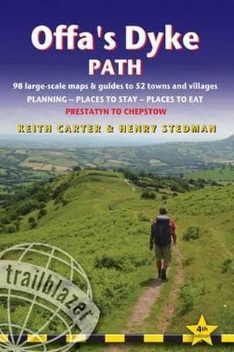
Hiking route guide to 177-mile path following Offa's Dyke, the 8th century earthwork along the Wales/England border. 98 large-scale maps; full details of all accommodations, restaurants, pubs.
Die Inhaltsangabe kann sich auf eine andere Ausgabe dieses Titels beziehen.
Über die Autorin bzw. den Autor
Keith Carter has over 40 years' experience of hiking Britain's long-distance paths with numerous magazine articles published on the subject.
Von der hinteren Coverseite
‘...the Trailblazer series stands head, shoulders, waist and ankles above the rest. They are particularly strong on mapping...’The Sunday TimesThe Offa’s Dyke Path is a superb National Trail that runs from the North Wales coast to the Severn Estuary following the line of Offa’s Dyke, an impressive 8th-century earthwork along the English/Welsh border. The ever-changing landscape – the Clwydian Range, the Shropshire Hills, the Black Mountains and the Wye Valley – is steeped in history and legend providing 177 miles (285km) of fascinating walking.Includes 98 walking maps – the largest-scale maps available At a scale of just under 1:20,000 (8cm or 31/8 inches to 1 mile) these are bigger than even the most detailed walking maps currently available in the shops.Unique mapping features – walking times, directions, tricky junctions, places to stay, places to eat, points of interest. These are not general-purpose maps but fully-edited maps drawn by walkers for walkers.Itineraries for all walkers – whether hiking the 177-mile route in its entirety or sampling the highlights on day walks or short breaks. Includes detailed public transport information for all access points.Practical information for all budgets what to see, where to stay, where to eat: pubs, hotels, B&B, camping, bunkhouses, hostels.
GPS waypoints. These are also downloadable from the Trailblazer website.
Includes extra colour sections: 16pp colour introduction and 16pp of colour mapping for stage sections (one stage per page) with trail profiles.
Auszug. © Genehmigter Nachdruck. Alle Rechte vorbehalten.
Introduction‘Wherever I have been in Wales, I have experienced nothing but kindness and hospitality, and when I return to my own country, I will say so’. George Borrow Wild Wales 1862
For 177 miles (285km), from Prestatyn in the north of Wales to Chepstow in the south, the Offa’s Dyke Path winds along the English-Welsh border, roughly following the line of the 1200-year-old frontier earthwork which gives it its name. This magnificent long-distance footpath ranges over terrain diverse as any you will find in Britain; it traverses the whaleback ridges of the Clwydian Hills, along canal towpaths and old drovers’ roads, beside the banks of the meandering Severn and Wye rivers, through the Shropshire hills and over the Black Mountains. The Border Country is the land of Merlin and Arthur, a land of history and legend, from which sprang Owain Glyndwr and the Lord of the Rings. To journey through it on foot is the finest way to discover one of Britain’s best-kept secrets.
You leave the North Wales coastline for a bracing walk over the Prestatyn hillside with its awesome views of the mountains of Snowdonia before you take to the small lanes and hedgerows of the Vale of Clwyd. This farmland introduction gives way to the splendid ridges of the Clwydian Range and fine walking. Beyond Llandegla you enter a region that might be part of Tolkien’s Middle Earth, the limestone cliffs and screes of the Eglwyseg Crags above the festival town of Llangollen. Then you follow the canals, crossing the magnificent Pontcysyllte Aqueduct; the inspiring views of the Marcher castle of Chirk herald your first glimpse of the Dyke itself.You continue across the Severn Plain on a more modern man-made embankment with panoramic views of the Breidden Hills and then up to the Iron Age hill-fort of Beacon Ring with its crown of trees. As you approach the halfway mark at Knighton, ‘the town on the dyke’, you come to a part of the route aptly named the Switchbacks. Then it’s on to Kington and the Hergest Ridge, a place of heather, gorse and wild ponies, with extensive views of the ‘blue-remembered’ hills of Shropshire and the Black Mountains of the Brecon Beacons National Park. Hay-on-Wye with its thirty or so second-hand book shops is a welcome stop for a night. From here the trail climbs over Hay Bluff to the Hatterrall Ridge following the spine of this fine massif.From Pandy you pass through a hidden world of intimate villages and quiet byways where you’re likely to meet only livestock and farm people. Monmouth is well worth exploring before the long walk down the River Wye’s wooded slopes, passing Tintern Abbey, to Chepstow and the end of this superb trail at Sedbury Cliffs.
„Über diesen Titel“ kann sich auf eine andere Ausgabe dieses Titels beziehen.
Suchergebnisse für Offa's Dyke Path: British Walking Guide with 98...

Beispielbild für diese ISBN
Offa's Dyke Path: British Walking Guide with 98 Large-Scale Walking Maps, Places to Stay, Places to Eat
Verlag:
Trailblazer Publications, 2015
ISBN 10: 1905864655
ISBN 13: 9781905864652
Gebraucht
Paperback
Anbieter: ThriftBooks-Atlanta, AUSTELL, GA, USA
Verkäuferbewertung 5 von 5 Sternen

Paperback. Zustand: Good. No Jacket. Former library book; Pages can have notes/highlighting. Spine may show signs of wear. ~ ThriftBooks: Read More, Spend Less. Artikel-Nr. G1905864655I3N10
Gebraucht kaufen
EUR 16,45
Versand gratis
Versand innerhalb von USA
Versand innerhalb von USA
Anzahl: 1 verfügbar
Beispielbild für diese ISBN
Offa's Dyke Path: Prestatyn to Chepstow: Planning, Places to Stay, Places to Eat
Verlag:
Trailblazer Publications, 2015
ISBN 10: 1905864655
ISBN 13: 9781905864652
Gebraucht
Paperback
Anbieter: WorldofBooks, Goring-By-Sea, WS, Vereinigtes Königreich
Verkäuferbewertung 5 von 5 Sternen
Paperback. Zustand: Very Good. The book has been read, but is in excellent condition. Pages are intact and not marred by notes or highlighting. The spine remains undamaged. Artikel-Nr. GOR007443613
Gebraucht kaufen
EUR 12,93
EUR 6,54 Versand
Versand von Vereinigtes Königreich nach USA
Versand von Vereinigtes Königreich nach USA
Anzahl: 2 verfügbar
Beispielbild für diese ISBN
Offa's Dyke Path: Trailblazer British Walking Guide: Practical Walking Guide from Prestatyn to Chepstow with 98 Large-Scale Maps & Guides to 52 Towns & Villages (British Walking Guides)
Anbieter: AwesomeBooks, Wallingford, Vereinigtes Königreich
Verkäuferbewertung 5 von 5 Sternen
Paperback. Zustand: Very Good. Offa's Dyke Path: Trailblazer British Walking Guide: Practical Walking Guide from Prestatyn to Chepstow with 98 Large-Scale Maps & Guides to 52 Towns & Villages (British Walking Guides) This book is in very good condition and will be shipped within 24 hours of ordering. The cover may have some limited signs of wear but the pages are clean, intact and the spine remains undamaged. This book has clearly been well maintained and looked after thus far. Money back guarantee if you are not satisfied. See all our books here, order more than 1 book and get discounted shipping. Artikel-Nr. 7719-9781905864652
Gebraucht kaufen
EUR 14,81
EUR 4,81 Versand
Versand von Vereinigtes Königreich nach USA
Versand von Vereinigtes Königreich nach USA
Anzahl: 2 verfügbar
Beispielbild für diese ISBN
Offa's Dyke Path : Prestatyn to Chepstow - Planning - Places to Stay - Places to Eat
Verlag:
Trailblazer Publications, 2015
ISBN 10: 1905864655
ISBN 13: 9781905864652
Gebraucht
Softcover
Anbieter: Better World Books Ltd, Dunfermline, Vereinigtes Königreich
Verkäuferbewertung 5 von 5 Sternen
Zustand: Very Good. Former library copy. Pages intact with possible writing/highlighting. Binding strong with minor wear. Dust jackets/supplements may not be included. Includes library markings. Stock photo provided. Product includes identifying sticker. Better World Books: Buy Books. Do Good. Artikel-Nr. 41096924-20
Gebraucht kaufen
EUR 16,38
EUR 5,84 Versand
Versand von Vereinigtes Königreich nach USA
Versand von Vereinigtes Königreich nach USA
Anzahl: 1 verfügbar
Foto des Verkäufers
Offa's Dyke Path: Prestatyn to Chepstow: Planning, Places to Stay, Places to Eat
Verlag:
Trailblazer Publications, 2015
ISBN 10: 1905864655
ISBN 13: 9781905864652
Gebraucht
Softcover
Anbieter: WeBuyBooks, Rossendale, LANCS, Vereinigtes Königreich
Verkäuferbewertung 5 von 5 Sternen
Zustand: Like New. Most items will be dispatched the same or the next working day. An apparently unread copy in perfect condition. Dust cover is intact with no nicks or tears. Spine has no signs of creasing. Pages are clean and not marred by notes or folds of any kind. Artikel-Nr. rev6842530407
Gebraucht kaufen
EUR 19,73
EUR 6,42 Versand
Versand von Vereinigtes Königreich nach USA
Versand von Vereinigtes Königreich nach USA
Anzahl: 3 verfügbar
Foto des Verkäufers
Offa's Dyke Path: Prestatyn to Chepstow: Planning, Places to Stay, Places to Eat
Verlag:
Trailblazer Publications, 2015
ISBN 10: 1905864655
ISBN 13: 9781905864652
Gebraucht
Softcover
Anbieter: WeBuyBooks, Rossendale, LANCS, Vereinigtes Königreich
Verkäuferbewertung 5 von 5 Sternen
Zustand: Good. Most items will be dispatched the same or the next working day. A copy that has been read but remains in clean condition. All of the pages are intact and the cover is intact and the spine may show signs of wear. The book may have minor markings which are not specifically mentioned. Ex library copy with usual stamps & stickers. Artikel-Nr. rev3952160845
Gebraucht kaufen
EUR 19,73
EUR 6,42 Versand
Versand von Vereinigtes Königreich nach USA
Versand von Vereinigtes Königreich nach USA
Anzahl: 2 verfügbar
Beispielbild für diese ISBN
Offa's Dyke Path: Trailblazer British Walking Guide: Practical Walking Guide from Prestatyn to Chepstow with 98 Large-Scale Maps & Guides to 52 Towns & Villages (British Walking Guides)
Verlag:
Trailblazer Publications 17/03/2015, 2015
ISBN 10: 1905864655
ISBN 13: 9781905864652
Gebraucht
Paperback
Anbieter: Bahamut Media, Reading, Vereinigtes Königreich
Verkäuferbewertung 5 von 5 Sternen
Paperback. Zustand: Very Good. Shipped within 24 hours from our UK warehouse. Clean, undamaged book with no damage to pages and minimal wear to the cover. Spine still tight, in very good condition. Remember if you are not happy, you are covered by our 100% money back guarantee. Artikel-Nr. 6545-9781905864652
Gebraucht kaufen
EUR 253,82
EUR 8,15 Versand
Versand von Vereinigtes Königreich nach USA
Versand von Vereinigtes Königreich nach USA
Anzahl: 1 verfügbar