Offa's Dyke Path Prestatyn to Chepstow: Planning, Places to Stay, Places to Eat, Includes 98 Large-scale Walking Maps (British Walking Guides) - Softcover
Inhaltsangabe
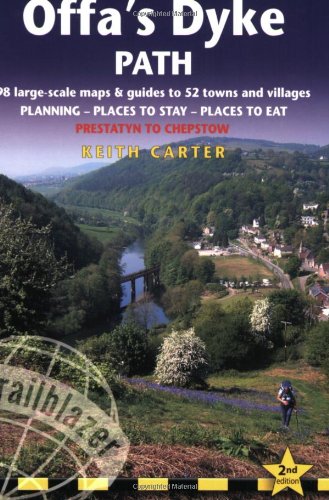
The Offa�s Dyke Path is a magnificent National Trail that runs from the North Wales coast to the Severn Estuary following the line of Offa�s Dyke, an impressive 8th century earthwork along the English/Welsh border. The ever-changing landscape ? the Wye Valley, the Black Mountains, the Shropshire Hills and the Clwydian Hills ? is steeped in history and legend providing 177 miles of fascinating walking.
* 88 walking maps ? 1:20,000 (3-1/8 inches to 1 mile) ? the largest-scale maps available.
* Unique mapping features ? walking times, directions, tricky junctions, places to stay, places to eat, points of interest.
* Includes day walks and short breaks.
* Practical information for all budgets ? what to see, where to stay, where to eat: pubs, B&Bs, hotels, campsites, hostels.
Die Inhaltsangabe kann sich auf eine andere Ausgabe dieses Titels beziehen.
�ber die Autorin bzw. den Autor
Keith Carter has 40 years� experience of hiking in Britain and has written for numerous walking publications and periodicals.
Von der hinteren Coverseite
?...the Trailblazer series stands head, shoulders, waist and ankles above the rest.
They are particularly strong on mapping...
The Sunday Times
The Offa s Dyke Path is a superb National Trail that runs from the North Wales coast to the Severn Estuary following the line of Offa s Dyke, an impressive 8th-century earthwork along the English/Welsh border. The ever-changing landscape ? the Clwydian Range, the Shropshire Hills, the Black Mountains and the Wye Valley ? is steeped in history and legend providing 177 miles (285km) of fascinating walking.
Includes 88 walking maps ? the largest-scale maps available
At a scale of just under 1:20,000 (8cm or 31/8 inches to 1 mile) these are bigger than even the most detailed walking maps currently available in the shops.
Unique mapping features ? walking times, directions, tricky junctions, places to stay, places to eat, points of interest. These are not general-purpose maps but fully-edited maps drawn by walkers for walkers.
Itineraries for all walkers ? whether hiking the 177-mile route in its entirety or sampling the highlights on day walks or short breaks. Includes detailed public transport information for all access points.
Practical information for all budgets
what to see, where to stay, where to eat: pubs, hotels, B&B, camping, bunkhouses, hostels.
��ber diesen Titel� kann sich auf eine andere Ausgabe dieses Titels beziehen.
Weitere beliebte Ausgaben desselben Titels

Suchergebnisse f�r Offa's Dyke Path Prestatyn to Chepstow: Planning,...

Beispielbild f�r diese ISBN
Offa's Dyke Path
Anbieter: WorldofBooks, Goring-By-Sea, WS, Vereinigtes K�nigreich
Verk�uferbewertung 5 von 5 Sternen
![]()
Paperback. Zustand: Very Good. The book has been read, but is in excellent condition. Pages are intact and not marred by notes or highlighting. The spine remains undamaged. Artikel-Nr. GOR004070980
Gebraucht kaufen
EUR 6,12
EUR 6,48 Versand
Versand von Vereinigtes K�nigreich nach USA
Versand von Vereinigtes K�nigreich nach USA
Anzahl: 10 verf�gbar
Beispielbild f�r diese ISBN
Offa's Dyke Path
Anbieter: AwesomeBooks, Wallingford, Vereinigtes K�nigreich
Verk�uferbewertung 5 von 5 Sternen
![]()
Paperback. Zustand: Very Good. Offa's Dyke Path This book is in very good condition and will be shipped within 24 hours of ordering. The cover may have some limited signs of wear but the pages are clean, intact and the spine remains undamaged. This book has clearly been well maintained and looked after thus far. Money back guarantee if you are not satisfied. See all our books here, order more than 1 book and get discounted shipping. Artikel-Nr. 6545-9781905864065
Gebraucht kaufen
EUR 11,14
EUR 5,77 Versand
Versand von Vereinigtes K�nigreich nach USA
Versand von Vereinigtes K�nigreich nach USA
Anzahl: 2 verf�gbar
Foto des Verk�ufers
Offa's Dyke Path
Verlag:
Trailblazer Publications, 2008
ISBN 10: 190586406X
ISBN 13: 9781905864065
Gebraucht
Softcover
Anbieter: WeBuyBooks, Rossendale, LANCS, Vereinigtes K�nigreich
Verk�uferbewertung 5 von 5 Sternen
![]()
Zustand: Good. Most items will be dispatched the same or the next working day. A copy that has been read but remains in clean condition. All of the pages are intact and the cover is intact and the spine may show signs of wear. The book may have minor markings which are not specifically mentioned. Artikel-Nr. wbb0021126869
Gebraucht kaufen
EUR 23,89
EUR 9,08 Versand
Versand von Vereinigtes K�nigreich nach USA
Versand von Vereinigtes K�nigreich nach USA
Anzahl: 1 verf�gbar