Verwandte Artikel zu Pictorial Maps (Art Reference)
Inhaltsangabe
Concerning the history and making of pictorial maps, a graphic form found increasingly in today's newspapers, magazines and television reporting, this book includes new Robinson projections that have solved many distortion problems, the computer's role in mapmaking and pictorial symbols. It begins with a history of pictorial maps through the ages, the use of pictorial maps in America, in the world, in war and news coverage and in weather reporting. The second half of the book concetrates on the mapmaking process itself in which Holmes shows how to achieve the various kinds of map projections in the age-old struggle to find a satisfactory way to show the entire surface of a 3-dimensional sphere on a a flat piece of paper. Included are the new Robinson projections that have solved many distortional problems, the computer's role in mapmaking, how to represent mountainous terrain convincingly, pictorial symbols used in maps and how to draw maps for friends.
Die Inhaltsangabe kann sich auf eine andere Ausgabe dieses Titels beziehen.
Rese�a del editor
Concerning the history and making of pictorial maps, a graphic form found increasingly in today's newspapers, magazines and television reporting, this book includes new Robinson projections that have solved many distortion problems, the computer's role in mapmaking and pictorial symbols. It begins with a history of pictorial maps through the ages, the use of pictorial maps in America, in the world, in war and news coverage and in weather reporting. The second half of the book concetrates on the mapmaking process itself in which Holmes shows how to achieve the various kinds of map projections in the age-old struggle to find a satisfactory way to show the entire surface of a 3-dimensional sphere on a a flat piece of paper. Included are the new Robinson projections that have solved many distortional problems, the computer's role in mapmaking, how to represent mountainous terrain convincingly, pictorial symbols used in maps and how to draw maps for friends.
��ber diesen Titel� kann sich auf eine andere Ausgabe dieses Titels beziehen.

Suchergebnisse f�r Pictorial Maps (Art Reference)

Beispielbild f�r diese ISBN
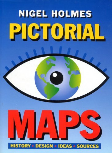
Pictorial Maps (Art Reference)
Anbieter: WorldofBooks, Goring-By-Sea, WS, Vereinigtes K�nigreich
Verk�uferbewertung 5 von 5 Sternen
![]()
Hardback. Zustand: Fair. Color And B/w Illustrations (illustrator). A readable copy of the book which may include some defects such as highlighting and notes. Cover and pages may be creased and show discolouration. Artikel-Nr. GOR006841754
Anzahl: 2 verf�gbar
Beispielbild f�r diese ISBN
Pictorial Maps (Art Reference)
Verlag:
Bloomsbury Publishing PLC, United Kingdom, London, 1992
ISBN 10: 1871569435
ISBN 13: 9781871569438
Gebraucht
Paperback
Anbieter: WorldofBooks, Goring-By-Sea, WS, Vereinigtes K�nigreich
Verk�uferbewertung 5 von 5 Sternen
![]()
Paperback. Zustand: Very Good. Color And B/w Illustrations (illustrator). Concerning the history and making of pictorial maps, a graphic form found increasingly in today's newspapers, magazines and television reporting, this book includes new Robinson projections that have solved many distortion problems, the computer's role in mapmaking and pictorial symbols. It begins with a history of pictorial maps through the ages, the use of pictorial maps in America, in the world, in war and news coverage and in weather reporting. The second half of the book concetrates on the mapmaking process itself in which Holmes shows how to achieve the various kinds of map projections in the age-old struggle to find a satisfactory way to show the entire surface of a 3-dimensional sphere on a a flat piece of paper. Included are the new Robinson projections that have solved many distortional problems, the computer's role in mapmaking, how to represent mountainous terrain convincingly, pictorial symbols used in maps and how to draw maps for friends. The book has been read, but is in excellent condition. Pages are intact and not marred by notes or highlighting. The spine remains undamaged. Artikel-Nr. GOR003737121
Anzahl: 2 verf�gbar
Foto des Verk�ufers
Pictorial Maps
Verlag:
Herbert Press Ltd, London, 1992
ISBN 10: 1871569435
ISBN 13: 9781871569438
Gebraucht
Hardcover
Erstausgabe
Anbieter: Linda Corrigan, Knutsford, Vereinigtes K�nigreich
Verk�uferbewertung 5 von 5 Sternen
![]()
Board. Zustand: Near Fine. Zustand des Schutzumschlags: Near Fine. Holmes, Nigel (illustrator). 1st Edition. A near fine copy in a near fine dust jacket of this lavishly illustrated study of pictorial maps. Dust Jacket: pictorial, laminated, with colour map of Europe and black lettering to all faces, all on a white ground; in excellent condition; very clean and bright; no fading; no visible sign of shelf wear not price clipped (now protected). Cover: blue laminated boards with silver lettering to spine; in excellent condition; very clean and bright, no visible signs of shelf wear. Internally: very clean and tightly bound; no inscriptions or book plates; looks unread. Illustrated throughout in colour and black and white. 192 pp. Artikel-Nr. 002459
Anzahl: 1 verf�gbar