Inhaltsangabe
Pathfinder� Cotswolds covering parts of the Snowshill, Buckholt Wood and Burford.
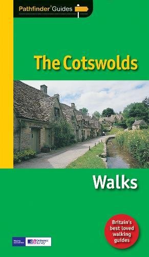
This selection offers interest, regional variety and balance of routes in the Cotswolds providing the best walks in the area. From an easy stroll through Castle Combe to the much more challenging walks on Bredon Hill this volume contains something for everyone. Covering walks through the whole of the Cotswolds both popular and little know scenic routes including Stanway, Bourton-on-the-Water and Blenheim Park.
-See walk locations by Looking Inside
Inside:
-28 great Cotswold walks from 2 to 10 miles
-Clear, large scale Ordnance Survey route maps
-GPS reference for all Cotswold waypoints
-Where to park, good pubs and places of interest en route
-All routes have been fully researched and written by expert outdoor writers
-Beautiful photography of scenes from the walks
Pathfinder� Guides are Britain’s best loved walking guides. Made with durable covers, they are the perfect companion for countryside walks throughout Britain. Each title features circular walks with easy-to-follow route descriptions, large-scale Ordnance Survey route maps and GPS waypoints. With over 70 titles in the series, they offer essential information for walkers throughout the country.
Die Inhaltsangabe kann sich auf eine andere Ausgabe dieses Titels beziehen.
Rese�a del editor
Pathfinder� Cotswolds covering parts of the Snowshill, Buckholt Wood and Burford.
This selection offers interest, regional variety and balance of routes in the Cotswolds providing the best walks in the area. From an easy stroll through Castle Combe to the much more challenging walks on Bredon Hill this volume contains something for everyone. Covering walks through the whole of the Cotswolds both popular and little know scenic routes including Stanway, Bourton-on-the-Water and Blenheim Park.
-See walk locations by Looking Inside
Inside:
-28 great Cotswold walks from 2 to 10 miles
-Clear, large scale Ordnance Survey route maps
-GPS reference for all Cotswold waypoints
-Where to park, good pubs and places of interest en route
-All routes have been fully researched and written by expert outdoor writers
-Beautiful photography of scenes from the walks
Pathfinder� Guides are Britain’s best loved walking guides. Made with durable covers, they are the perfect companion for countryside walks throughout Britain. Each title features circular walks with easy-to-follow route descriptions, large-scale Ordnance Survey route maps and GPS waypoints. With over 70 titles in the series, they offer essential information for walkers throughout the country.
Extracto. � Reimpreso con autorizaci�n. Reservados todos los derechos.
Walk One: Minster Lovell and the River Windrush
Start: Minster Lovell
Distance: 3.5 miles (5.5km)
Approx Time: 2 hours
Parking: Wash Meadow Recreation Ground, Minster Lovell
Refreshments: Pub at Minster Lovell, pub at Crawley T
his is a relaxing half-day stroll amidst the gently scenery of the Windrush Valley which lies between the exceptionally interesting village of Minster Lovell and Witney. The first part of the route across the water meadows by the river is delightful. Then the route heads across to the village of Crawley, returning to Minster Lovell along the edge of the valley from where there are some fine views. The walks begins at the car park by the bridge over the Windrush.
Follow the direction of a 'Circular Walk' footpath sign diagonally across a recreation ground to two kissing-dates. Continue along the left-hand edge of a meadow and soon there is a fine view of the church and hall in front; bear left over a footbridge and follow the path towards the church. Climb another stile to enter the churchyard and walk between the church and highly atmospheric ruins of Minster Lovell Hall, following the path round to the right to a kissing-gate.
��ber diesen Titel� kann sich auf eine andere Ausgabe dieses Titels beziehen.
Suchergebnisse f�r Pathfinder Cotswolds: 6 (Pathfinder Guide)

Foto des Verk�ufers
Pathfinder Cotswolds: 6 (Pathfinder Guide)
Anbieter: WeBuyBooks, Rossendale, LANCS, Vereinigtes K�nigreich
Verk�uferbewertung 5 von 5 Sternen
![]()
Zustand: Very Good. Most items will be dispatched the same or the next working day. A copy that has been read, but is in excellent condition. Pages are intact and not marred by notes or highlighting. The spine remains undamaged. Artikel-Nr. wbs3018695628
Gebraucht kaufen
EUR 1,62
Versand:
EUR 7,14
Von Vereinigtes K�nigreich nach USA
Anzahl: 1 verf�gbar
Foto des Verk�ufers
Pathfinder Cotswolds: 6 (Pathfinder Guide)
Anbieter: WeBuyBooks, Rossendale, LANCS, Vereinigtes K�nigreich
Verk�uferbewertung 5 von 5 Sternen
![]()
Zustand: Like New. Most items will be dispatched the same or the next working day. An apparently unread copy in perfect condition. Dust cover is intact with no nicks or tears. Spine has no signs of creasing. Pages are clean and not marred by notes or folds of any kind. Artikel-Nr. wbs9172319623
Gebraucht kaufen
EUR 1,62
Versand:
EUR 7,14
Von Vereinigtes K�nigreich nach USA
Anzahl: 1 verf�gbar
Beispielbild f�r diese ISBN
Pathfinder Cotswolds (Pathfinder Guide)
Anbieter: Reuseabook, Gloucester, GLOS, Vereinigtes K�nigreich
Verk�uferbewertung 5 von 5 Sternen
![]()
Paperback. Zustand: Used; Good. Dispatched, from the UK, within 48 hours of ordering. This book is in good condition but will show signs of previous ownership. Please expect some creasing to the spine and/or minor damage to the cover. Artikel-Nr. CHL1004496
Gebraucht kaufen
EUR 3,74
Versand:
EUR 6,24
Von Vereinigtes K�nigreich nach USA
Anzahl: 1 verf�gbar
Beispielbild f�r diese ISBN
Pathfinder Cotswolds (Pathfinder Guide)
Anbieter: Reuseabook, Gloucester, GLOS, Vereinigtes K�nigreich
Verk�uferbewertung 5 von 5 Sternen
![]()
Paperback. Zustand: Used; Very Good. Dispatched, from the UK, within 48 hours of ordering. Though second-hand, the book is still in very good shape. Minimal signs of usage may include very minor creasing on the cover or on the spine. Artikel-Nr. CHL1352380
Gebraucht kaufen
EUR 3,74
Versand:
EUR 6,24
Von Vereinigtes K�nigreich nach USA
Anzahl: 1 verf�gbar
Beispielbild f�r diese ISBN
Pathfinder Cotswolds: 6 (Pathfinder Guide)
Anbieter: WorldofBooks, Goring-By-Sea, WS, Vereinigtes K�nigreich
Verk�uferbewertung 5 von 5 Sternen
![]()
Paperback. Zustand: Very Good. The book has been read, but is in excellent condition. Pages are intact and not marred by notes or highlighting. The spine remains undamaged. Artikel-Nr. GOR004947171
Gebraucht kaufen
EUR 6,83
Versand:
EUR 6,35
Von Vereinigtes K�nigreich nach USA
Anzahl: 10 verf�gbar