Verwandte Artikel zu Mapping and Navigation: Explore the History and Science...
Mapping and Navigation: Explore the History and Science of Finding Your Way: Explore the History and Science of Finding Your Way, With 20 Projects (Build It Yourself) - Softcover
Inhaltsangabe
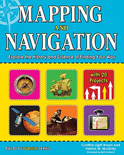
How did we get from 20-foot-long maps to GPS devices small enough to fit in the palm of our hands? How does GPS work and what can it tell us? How do ancient mapmaking techniques used by the Romans and Greeks influence the satellite technologies we use today? The history of mapmaking is full of remarkable characters who charted the unknown with an ever-changing set of tools. In Mapping and Navigation: The History and Science of Finding Your Way, kids ages 9–12 will learn the history and science behind the evolution of mapmaking, and how much is still out there for discovery.
Readers will explore ideas through hands-on experiments while learning new terminology and interesting facts. Projects include using triangulation to measure distances, creating contour lines on a mini-mountain to understand elevation changes on a map, and inventing a sundial and compass to understand the basics of navigation. Whether mapping the solar system or mapping their own backyard, all readers will be able to understand mapping technologies and see the world in new and exciting ways.
Die Inhaltsangabe kann sich auf eine andere Ausgabe dieses Titels beziehen.
�ber die Autorinnen und Autoren
Cynthia Light Brown is the author of several books for Nomad Press, including Amazing Kitchen Chemistry Projects You Can Build Yourself, Explore Rocks and Minerals!, and Geology of the Pacific Northwest. She has 21 years of experience as an environmental consultant specializing in pollution prevention, toxicology, and using Geographic Information Systems for mapping natural resources and protecting the environment. Cynthia lives in Pittsburgh, Pennsylvania.
Patrick McGinty holds an MFA in Writing from Portland State University and currently teaches in the English department there. He is a regular columnist for Propeller Magazine. Patrick lives in Portland, Oregon.
Beth Hetland has an MFA from the Center for Cartoon Studies and has illustrated Backyard Biology: Investigate Habitats Outside Your Door and Native Americans: Discover the History and Cultures of the First Americans. She lives in Chicago, Illinois.
Cynthia Light Brown is the author of Amazing Kitchen Chemistry Projects You Can Build Yourself, Discover National Monuments, Explore Rocks and Minerals!, Geology of the Desert Southwest, and Geology of the Pacific Northwest. She is a founding partner and vice president of Clover Leaf Environmental Solutions with 21 years of experience as an environmental consultant specializing in pollution prevention, toxicology, and risk assessment. She lives in Pittsburgh, Pennsylvania. Beth Hetland has an MFA from the Center for Cartoon Studies and is an illustrator of comics. She lives in Chicago.
Von der hinteren Coverseite
How did we get from 20-foot-long maps to GPS devices small enough to fit in the palm of our hands? How does GPS work and what can it tell us? How do ancient mapmaking techniques used by the Romans and Greeks influence the satellite technologies we use today? The history of mapmaking is full of remarkable characters who charted the unknown with an ever-changing set of tools. In Mapping and Navigation: The History and Science of Finding Your Way, kids ages 9–12 will learn the history and science behind the evolution of mapmaking, and how much is still out there for discovery.
Readers will explore ideas through hands-on experiments while learning new terminology and interesting facts. Projects include using triangulation to measure distances, creating contour lines on a mini-mountain to understand elevation changes on a map, and inventing a sundial and compass to understand the basics of navigation. Whether mapping the solar system or mapping their own backyard, all readers will be able to understand mapping technologies and see the world in new and exciting ways.
Mapping and Navigation meets common core state standards in language arts for reading informational text and literary nonfiction and is aligned with Next Generation Science Standards. Guided Reading Levels and Lexile measurements indicate grade level and text complexity.
��ber diesen Titel� kann sich auf eine andere Ausgabe dieses Titels beziehen.
Weitere beliebte Ausgaben desselben Titels

Suchergebnisse f�r Mapping and Navigation: Explore the History and Science...

Beispielbild f�r diese ISBN
Mapping and Navigation: Explore the History and Science of Finding Your Way with 20 Projects (Build It Yourself)
Anbieter: World of Books (was SecondSale), Montgomery, IL, USA
Verk�uferbewertung 5 von 5 Sternen
![]()
Zustand: Good. Hetland, Beth (illustrator). Item in good condition. Textbooks may not include supplemental items i.e. CDs, access codes etc. Artikel-Nr. 00105615385
Gebraucht kaufen
EUR 12,20
Versand gratis
Versand innerhalb von USA
Versand innerhalb von USA
Anzahl: 1 verf�gbar