Verwandte Artikel zu Trading Territories: Mapping the Early Modern World
Zu dieser ISBN ist aktuell kein Angebot verf�gbar.
Alle Exemplare der Ausgabe mit dieser ISBN anzeigen:
Book by Brotton Jerry
Die Inhaltsangabe kann sich auf eine andere Ausgabe dieses Titels beziehen.
Cr�ticas:
"In this outstanding study of maps and mapping, Jerry Brotton reveals a dynamism in the transaction between East and West beyond anything we have previously appreciated."-Lisa Jardine, Queen Mary and Westfield College, University of London "Brotton succeeds admirably in looking at maps and mapping in original and provocative ways. He uses a wealth of materials to produce a small book that bristles with interesting ideas and perspectives."-Larry Wolff, Boston College "Jerry Brotton brings a literary critic's eye for textual nuance to the rapid developments within European cartography in the late fifteenth and sixteenth centuries. There are plenty of fresh, insightful readings in this book. . . . Fresh or contentious ideas appear on virtually every page and the book repays careful reading and rereading."-James Robertson, Sixteenth Century Journal "Jerry Brotton is part of that exciting new world of interactivity between disciplines that would, until not long ago, have been regarded as separate and impermeable. . . . His is an outstanding achievement of meticulous research and scholarly rigour, yet animated by a method of enquiry that is enriched by being accustomed to reading texts according to literary protocols. . . . Brotton's study takes us beyond the limits of physical voyages of discovery into what Andrew Marvell described as 'far other worlds and other seas', regions of mind and imagination."-Christopher Wortham, Parergon "The precise arguments and materials here are quite distinctive and novel. . . In showing that maps actively constructed as well as represented the new spaces opened up by exploration, Brotton also significantly reinforces the claim of those who decry the simple empiricist position that maps always came 'after territory' rather than, more often than not, prefiguring what was and was not 'discovered.' It is this point of view that makes maps so important . . . as sources for detecting the complex motivations and understandings that drove European commercial and territorial expansion in the first place."-John Agnew, Journal of Modern History "Brotton successfully examines the function and role of chart, map, and globe from the Middle Ages to the 16th century. . . . A well-produced book. Recommended for all levels."-Choice "This important book not only treats the ways early modern geographers defined the world's spaces but also makes significant contributions to the history of cartography, printing, and cultural exchange and diversity. Brotton . . . stresses that Renaissance explorers ventured across the Atlantic and Pacific not out of curiosity or to pursue new intellectual horizons but to seek the goods Europeans lacked and markets for European products. Early-16th-century map production aimed not so much at scientific accuracy as at justifications for wide national authority and territory, often making crucial Western reliance on Ottoman cartography. . . . Recommended for geographical and historical collections."-Library Journal "Brotton clearly shows the commercial and political pressures that made mapmaking so important during the 1600s . . . The book excellently tells the story of mapmakers' progressing from servants whose maps distorted kings' territories to independent scholars whose maps' political neutrality and geographical accuracy were rewarded by private companies. . . . Map buffs and those interested in early world exploration should enjoy this one."-Booklist
Rese�a del editor:
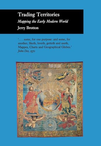
In this generously illustrated book, Jerry Brotton documents the dramatic changes in the nature of geographical representation which took place during the sixteenth century, explaining how much they convey about the transformation of European culture at the end of the early modern era. He examines the age's fascination with maps, charts, and globes as both texts and artifacts that provided their owners with a promise of gain, be it intellectual, political, or financial. From the Middle Ages through most of the sixteenth century, Brotton argues, mapmakers deliberately exploited the partial, often conflicting accounts of geographically distant territories to create imaginary worlds. As long as the lands remained inaccessible, these maps and globes were politically compelling. They bolstered the authority of the imperial patrons who employed the geographers and integrated their creations into ever more grandiose rhetorics of expansion. As the century progressed, however, geographers increasingly owed allegiance to the administrators of vast joint-stock companies that sought to exploit faraway lands and required the systematic mapping of commercially strategic territories. By the beginning of the seventeenth century, maps had begun to serve instead as scientific guides, defining objectively valid images of the world.
��ber diesen Titel� kann sich auf eine andere Ausgabe dieses Titels beziehen.
- VerlagCornell University Press
- Erscheinungsdatum1997
- ISBN 10 0801434998
- ISBN 13 9780801434990
- EinbandTapa dura
- Anzahl der Seiten256
- Bewertung
Neu kaufen
Mehr zu diesem Angebot erfahren
EUR 96,85
Versand:
EUR 48,99
Von Deutschland nach USA
Beste Suchergebnisse beim ZVAB
Foto des Verk�ufers
TRADING TERRITORIES
Verlag:
CORNELL UNIV PR
(1997)
ISBN 10: 0801434998
ISBN 13: 9780801434990
Neu
Hardcover
Anzahl: > 20
Anbieter:
Bewertung
Buchbeschreibung Zustand: New. KlappentextrnrnIn this generously illustrated book, Jerry Brotton documents the dramatic changes in the nature of geographical representation which took place during the sixteenth century, explaining how much they convey about the transformation. Artikel-Nr. 898713666
Weitere Informationen zu diesem Verk�ufer | Verk�ufer kontaktieren
Neu kaufen
EUR 96,85
W�hrung umrechnen