Inhaltsangabe
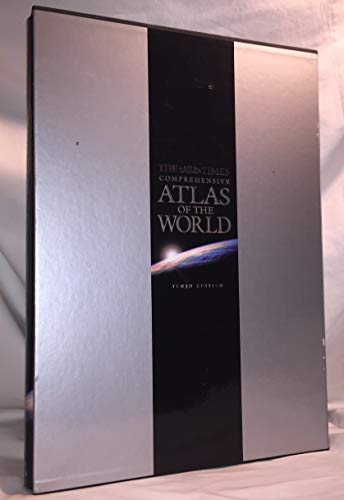
The Millennium edition of the world’s most prestigious reference atlas, The Times Comprehensive Atlas of the World, featuring 248 pages of new, digitally created mapping and a specially commissioned 72 page introductory section to celebrate the millennium. Index to over 200,000 place names.
This 10th edition is the first entirely new edition of the atlas since the five volume Mid-Century Edition. In the fifty years since that edition was published, the art and science of cartography have been revolutionised : mapping created on hand-etched copper plates has been replaced by mapping computer generated from world and regional databases.
The atlas in introduced by unique satellite images of the continents as they appear from space. This preliminary section continues with a series of innovative images, maps, photographs and graphics reviewing the cosmos and the natural world, and man’s interaction with it at the end of the second millennium; the images and maps themselves illustrate how satellite technology continues to extend our knowledge of the earth. The section continues by chronicling the evolution of the world map and concludes with a geographical information summary on physical features, states and territories.
The reference maps that follow present the most accurate and up-to-date representation of our knowledge of the earth today. The area shown, and the scale and projection of each plate, have been entirely redesigned using computer technology to allow each plate to be individually generated to optimum parameters. As well as creating mapping of enhanced accuracy, the technology used has allowed the design to be even clearer and more accessible. The number of plates has been extended to include detailed large scale coverage of more regions to provide ever more comprehensive coverage of each country in the world.
The gazetteer-index to over 200,000 geographical features illustrates the unique scope of the atlas; the gazetteer is fully cross-referenced with alternative and former names and is supported by a glossary of geographical terms used in the atlas.
The atlas includes:
- 72 page introductory section
- 248 pages of reference maps of continents, countries and oceans
- 224 page gazetteer index to over 200,000 geographical features
Die Inhaltsangabe kann sich auf eine andere Ausgabe dieses Titels beziehen.
Von der hinteren Coverseite
This Millennium edition (the 10th edition) is the first entirely new edition of the atlas since the five volume Mid-Century Edition. In the fifty years since that edition was published, the art and science of cartography have been revolutionised : mapping created on hand-etched copper plates has been replaced by mapping computer generated from world and regional databases.
The atlas in introduced by unique satellite images of the continents as they appear from space. This preliminary section continues with a series of innovative images, maps, photographs and graphics reviewing the cosmos and the natural world, and man’s interaction with it at the end of the second millennium; the images and maps themselves illustrate how satellite technology continues to extend our knowledge of the earth. The section continues by chronicling the evolution of the world map as man set out to explore the world around him over a thousand years ago, and concludes with a geographical information summary on physical features, states and territories.
The plates of reference maps that follow present the most accurate and up-to-date representation of our knowledge of the earth today. The area shown, and the scale and projection of each plate, have been entirely redesigned using computer technology to allow each plate to be individually generated to optimum parameters. As well as creating mapping of enhanced accuracy, the technology used has allowed the design to be even clearer and more accessible. The number of plates has been extended to include detailed large scale coverage of more regions to provide ever more comprehensive coverage of each country in the world.
The gazetteer-index to over 200,000 geographical features illustrates the unique scope of the atlas; the gazetteer is fully cross-referenced with alternative and former names and is supported by a glossary of geographical terms used in the atlas.
The atlas includes
• 72 page introductory section
• 248 pages of reference maps of continents, countries and oceans
• 224 page gazetteer index to over 225,000 geographical features
��ber diesen Titel� kann sich auf eine andere Ausgabe dieses Titels beziehen.
Weitere beliebte Ausgaben desselben Titels

Suchergebnisse f�r The Times Atlas of the World (The "Times" Comprehens...

Beispielbild f�r diese ISBN
"The Times" Comprehensive Atlas of the World 2000 (10th Edition)
Anbieter: WorldofBooks, Goring-By-Sea, WS, Vereinigtes K�nigreich
Verk�uferbewertung 5 von 5 Sternen
![]()
Hardback. Zustand: Very Good. The book has been read, but is in excellent condition. Pages are intact and not marred by notes or highlighting. The spine remains undamaged. Artikel-Nr. GOR004129427
Gebraucht kaufen
EUR 5,66
EUR 6,47 Versand
Versand von Vereinigtes K�nigreich nach USA
Versand von Vereinigtes K�nigreich nach USA
Anzahl: 2 verf�gbar
Beispielbild f�r diese ISBN
"The Times" Comprehensive Atlas of the World 2000 (10th Edition)
Anbieter: Sell Books, Elland, YORKS, Vereinigtes K�nigreich
Verk�uferbewertung 5 von 5 Sternen
![]()
hardcover. Zustand: Good. Our good condition books are generally good for reading but not for gifting or collecting. They could have imperfections such as creasing, fanning, inscriptions, margin notes, yellowing, staining on edge or cover or pages, bumps, scuffs, etc etc (sometimes multiple of these). It's a wide category that encompasses anything that isn't almost-new down to anything that is slightly better than poor. We would NOT recommend gifting Good books - these should be considered reading copies. Our books are dispatched from a Yorkshire former cotton mill. We list via barcode/ISBN so please note that the images are stock images and may not be the exact copy you receive, furthermore the details about edition and year might not be accurate as many publishers reuse the same ISBN for multiple editions and as we simply scan a barcode or enter an ISBN we do not check the validity of the edition data when listing. If you're looking for an exact edition please don't order (at least not without checking with us first, although we don't always have time to check). We aim to dispatch prompty, the service used will depend on order value and book size. We can ship to most countries, see our shipping policies. Payment is via Abe only. Artikel-Nr. P-BB100268-MIX-20251103-G
Gebraucht kaufen
EUR 5,68
EUR 14,04 Versand
Versand von Vereinigtes K�nigreich nach USA
Versand von Vereinigtes K�nigreich nach USA
Anzahl: 1 verf�gbar
Foto des Verk�ufers
The Times Comprehensive Atlas of the World: Millennium Edition
Verlag:
Times Books, London, UK, 2000
ISBN 10: 0723007926
ISBN 13: 9780723007920
Gebraucht
Hardcover
Anbieter: All Lost Books, Wollaston, Vereinigtes K�nigreich
Verk�uferbewertung 5 von 5 Sternen
![]()
Hardcover. Zustand: Very Good. Zustand des Schutzumschlags: Very Good. Includes 124*colour plates, most of double page size. 593pp. Light wear to edges of DJ. Book weighs 5kg, additional postage fee will be required. Artikel-Nr. 52608
Gebraucht kaufen
EUR 20,24
EUR 23,35 Versand
Versand von Vereinigtes K�nigreich nach USA
Versand von Vereinigtes K�nigreich nach USA
Anzahl: 1 verf�gbar
Foto des Verk�ufers
"The Times" Comprehensive Atlas of the World 2000 (10th Edition)
Anbieter: WeBuyBooks, Rossendale, LANCS, Vereinigtes K�nigreich
Verk�uferbewertung 5 von 5 Sternen
![]()
Zustand: Very Good. Most items will be dispatched the same or the next working day. A copy that has been read, but is in excellent condition. Pages are intact and not marred by notes or highlighting. The spine remains undamaged. Artikel-Nr. rev6082090079
Gebraucht kaufen
EUR 5,90
EUR 43,88 Versand
Versand von Vereinigtes K�nigreich nach USA
Versand von Vereinigtes K�nigreich nach USA
Anzahl: 1 verf�gbar
Foto des Verk�ufers
"The Times" Comprehensive Atlas of the World 2000 (10th Edition)
Anbieter: WeBuyBooks, Rossendale, LANCS, Vereinigtes K�nigreich
Verk�uferbewertung 5 von 5 Sternen
![]()
Zustand: Good. Most items will be dispatched the same or the next working day. A copy that has been read but remains in clean condition. All of the pages are intact and the cover is intact and the spine may show signs of wear. The book may have minor markings which are not specifically mentioned. Artikel-Nr. rev5630042744
Gebraucht kaufen
EUR 5,90
EUR 43,88 Versand
Versand von Vereinigtes K�nigreich nach USA
Versand von Vereinigtes K�nigreich nach USA
Anzahl: 1 verf�gbar
Foto des Verk�ufers
" The Times " Comprehensive Atlas of the World 2000
Anbieter: Chapter 1, Johannesburg, GAU, S�dafrika
Verk�uferbewertung 5 von 5 Sternen
![]()
Hardcover. Zustand: As New. Zustand des Schutzumschlags: As New. Tenth Edition. very heavy, will require extra postage. a neat copy. shelf wear on the slipcase. the book and jacket appear barely used and in almost new condition. [SK]. Our orders are shipped using tracked courier delivery services. Artikel-Nr. 80tl
Gebraucht kaufen
EUR 29,27
EUR 25,00 Versand
Versand von S�dafrika nach USA
Versand von S�dafrika nach USA
Anzahl: 1 verf�gbar
Foto des Verk�ufers
The Times Comprehensive Atlas of the World
Anbieter: Round Table Books, LLC, Gurnee, IL, USA
Verk�uferbewertung 4 von 5 Sternen
![]()
Hard Cover. Zustand: Near Fine. Zustand des Schutzumschlags: Very Good-. Tenth Edition. First Printing. Publisher's full black cloth, silver lettering on spine and cover, Key to Map Plates on endpapers. Profusely illustrated with 124 full and double-page large scale color maps. Includes a 6-page Glossary, and a 220 page Index-Gazatteer listing over 200,000 geographical features. . The volume, the unclipped dust jacket, and the slipcase are all in perfect, pristine condition; unmarked, unread, tight, square, clean and fresh. An extremely large, heavy book (13 pounds) - additional shipping charges may apply.AS NEW/AS NEW. . Color maps. Folio 13" - 23" tall. 124, 6, 220, (1) pp. Artikel-Nr. 29822
Gebraucht kaufen
EUR 66,52
EUR 5,60 Versand
Versand innerhalb von USA
Versand innerhalb von USA
Anzahl: 1 verf�gbar
Foto des Verk�ufers
THE TIMES COMPREHENSIVE ATLAS OF THE WORLD
Anbieter: Stella & Rose's Books, PBFA, Tintern, MON, Vereinigtes K�nigreich
Verk�uferbewertung 5 von 5 Sternen
![]()
Hardback. Zustand: Fine. Zustand des Schutzumschlags: Very Good. 2001. Nearly fine condition in a nearly fine dustwrapper. Very large format. Tenth Edition reprinted with changes. Black cloth boards, silver titles. Superb colour maps. Blue ribbon page marker. Slight bumping to spine. Contents fine. Some light scuffing to dustwrapper. Contained in slipcase which is lightly scuffed and and rubbed at edges. Packaged with care and promptly dispatched! Artikel-Nr. 1325738
Gebraucht kaufen
EUR 60,00
EUR 18,49 Versand
Versand von Vereinigtes K�nigreich nach USA
Versand von Vereinigtes K�nigreich nach USA
Anzahl: 1 verf�gbar
Foto des Verk�ufers
The Times comprehensive atlas of the world
Anbieter: Acanthophyllum Books, Holywell, FLINT, Vereinigtes K�nigreich
Verk�uferbewertung 3 von 5 Sternen
![]()
Zustand: Fine. Zustand des Schutzumschlags: Fine. 10th edition. Slip case sl. soiled; atlas as new. Weight: 1 Language: English Hard covers, dust jacket; in slip case. Artikel-Nr. 9869
Gebraucht kaufen
EUR 59,53
EUR 25,37 Versand
Versand von Vereinigtes K�nigreich nach USA
Versand von Vereinigtes K�nigreich nach USA
Anzahl: 1 verf�gbar
Foto des Verk�ufers
TIMES ATLAS COMPREHENSIVE
Anbieter: PearlPress, Camperdown, NSW, Australien
Verk�uferbewertung 4 von 5 Sternen
![]()
Hardcover. Zustand: As New. Book is new never read but has tiny shipping marks - please see photos. The Millennium edition of the world's most prestigious reference atlas, The Times Comprehensive Atlas of the World, featuring 248 pages of new, digitally created mapping and a specially commissioned 72 page introductory section to celebrate the millennium. Index to over 200,000 place names. This 10th edition is the first entirely new edition of the atlas since the five volume Mid-Century Edition. In the fifty years since that edition was published, the art and science of cartography have been revolutionised : mapping created on hand-etched copper plates has been replaced by mapping computer generated from world and regional databases. The atlas in introduced by unique satellite images of the continents as they appear from space. This preliminary section continues with a series of innovative images, maps, photographs and graphics reviewing the cosmos and the natural world, and man's interaction with it at the end of the second millennium; the images and maps themselves illustrate how satellite technology continues to extend our knowledge of the earth. The section continues by chronicling the evolution of the world map and concludes with a geographical information summary on physical features, states and territories. The reference maps that follow present the most accurate and up-to-date representation of our knowledge of the earth today. The area shown, and the scale and projection of each plate, have been entirely redesigned using computer technology to allow each plate to be individually generated to optimum parameters. As well as creating mapping of enhanced accuracy, the technology used has allowed the design to be even clearer and more accessible. The number of plates has been extended to include detailed large scale coverage of more regions to provide ever more comprehensive coverage of each country in the world. The gazetteer-index to over 200,000 geographical features illustrates the unique scope of the atlas; the gazetteer is fully cross-referenced with alternative and former names and is supported by a glossary of geographical terms used in the atlas. Artikel-Nr. T51125029
Gebraucht kaufen
EUR 58,18
EUR 35,09 Versand
Versand von Australien nach USA
Versand von Australien nach USA
Anzahl: 1 verf�gbar