Inhaltsangabe
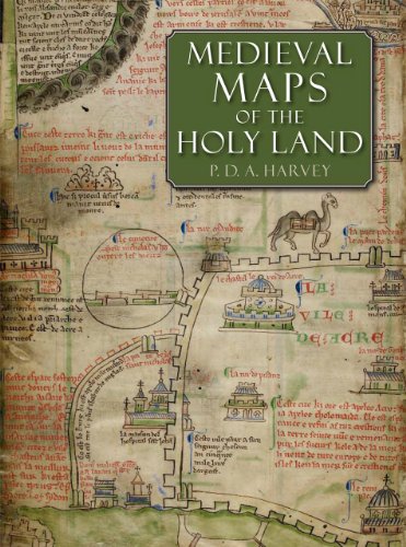
This study examines the eight known medieval regional maps of the Holy Land. Interesting, picturesque, and often colorful, these maps provide great insight into how the Holy Land was perceived by Western Europe in the age of the Crusades. Many of the surviving copies and fragments from the period are reproduced here for the first time, including three large maps that are among medieval Europe�s finest cartographic monuments.
In the course of this study P. D. A. Harvey, a leading historian of medieval maps, undertook detailed detective work that revealed many new discoveries, such as two maps hidden behind newer renditions, a map that was transformed into an erotic fantasy by a nineteenth-century forger, and information about the origin of a mysterious grid pattern on some of the maps. The research and illustrations presented inMedieval Maps of the Holy Land constitute an important contribution to the studies of medieval culture, early mapping, and crusading Europe.
Die Inhaltsangabe kann sich auf eine andere Ausgabe dieses Titels beziehen.
�ber die Autorin bzw. den Autor
P. D. A. Harvey is professor emeritus of medieval history at the University of Durham in England.
��ber diesen Titel� kann sich auf eine andere Ausgabe dieses Titels beziehen.
Suchergebnisse f�r Medieval Maps of the Holy Land

Foto des Verk�ufers
Medieval Maps of the Holy Land
Anbieter: Bookbot, Prague, Tschechien
Verk�uferbewertung 5 von 5 Sternen
![]()
Hardcover. Zustand: Fair. Beschriftungen / Markierungen bis 20 %; Leichte Rillen / Abschurfungen / Risse / Knicke. This study examines the eight known medieval regional maps of the Holy Land. Interesting, picturesque, and often colorful, these maps provide great insight into how the Holy Land was perceived by Western Europe in the age of the Crusades. Many of the surviving copies and fragments from the period are reproduced here for the first time, including three large maps that are among medieval Europe's finest cartographic monuments. In the course of this study P. D. A. Harvey, a leading historian of medieval maps, undertook detailed detective work that revealed many new discoveries, such as two maps hidden behind newer renditions, a map that was transformed into an erotic fantasy by a nineteenth-century forger, and information about the origin of a mysterious grid pattern on some of the maps. The research and illustrations presented in Medieval Maps of the Holy Land constitute an important contribution to the studies of medieval culture, early mapping, and crusading Europe. Artikel-Nr. 54574044-b550-408f-8545-5aabb4143056
Gebraucht kaufen
EUR 48,78
EUR 20,99 Versand
Versand von Tschechien nach USA
Versand von Tschechien nach USA
Anzahl: 1 verf�gbar
Foto des Verk�ufers
Medieval Maps of the Holy Land. First Edition.
Verlag:
British Library Press, 2012
ISBN 10: 0712358242
ISBN 13: 9780712358248
Gebraucht
Hardcover
Erstausgabe
Anbieter: Plurabelle Books Ltd, Cambridge, Vereinigtes K�nigreich
Verk�uferbewertung 5 von 5 Sternen
![]()
Hardback. Zustand: As New. xvi 160p large format hardback with glossy moss-green jacket, like new condition, free from wear, firm binding, pages exceptionally clean and bright, clear colour map images throughout, large fold-out colour maps, free from all marks and notes, a very good copy Language: English Weight (g): 1402. Artikel-Nr. 239500
Gebraucht kaufen
EUR 85,59
EUR 9,23 Versand
Versand von Vereinigtes K�nigreich nach USA
Versand von Vereinigtes K�nigreich nach USA
Anzahl: 1 verf�gbar
Beispielbild f�r diese ISBN
Medieval Maps of the Holy Land
Anbieter: Revaluation Books, Exeter, Vereinigtes K�nigreich
Verk�uferbewertung 5 von 5 Sternen
![]()
Hardcover. Zustand: Brand New. 208 pages. 12.13x1.10x9.29 inches. In Stock. Artikel-Nr. zk0712358242
Neu kaufen
EUR 163,80
EUR 17,31 Versand
Versand von Vereinigtes K�nigreich nach USA
Versand von Vereinigtes K�nigreich nach USA
Anzahl: 1 verf�gbar