Inhaltsangabe
The National Book Award–winning epic chronicle of the creation of the Panama Canal, a first-rate drama of the bold and brilliant engineering feat that transformed global trade routes and shaped modern American history, as told by Pulitzer Prize–winning author and master historian David McCullough.
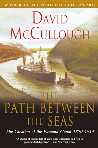
A national bestseller and testament to human determination, The Path Between the Seas tells the stories of the men and women who fought against all odds to fulfill the 400-year-old dream of constructing a maritime passageway between the Atlantic and Pacific oceans. McCullough masterfully recounts astonishing engineering and medical accomplishments, political power plays, heroic successes, and tragic failures. Applying his remarkable gift for writing lucid, lively exposition, McCullough weaves the many strands of the momentous event into a comprehensive and captivating tale.
Winner of the National Book Award for history, the Francis Parkman Prize, the Samuel Eliot Morison Award, and the Cornelius Ryan Award (for the best book of the year on international affairs), The Path Between the Seas is a must-read for anyone interested in American history, technological innovation, international intrigue, and human drama.
Die Inhaltsangabe kann sich auf eine andere Ausgabe dieses Titels beziehen.
�ber die Autorin bzw. den Autor
David McCullough (1933–2022) twice received the Pulitzer Prize, for Truman and John Adams, and twice received the National Book Award, for The Path Between the Seas and Mornings on Horseback. His other acclaimed books include The Johnstown Flood, The Great Bridge, Brave Companions, 1776, The Greater Journey, The American Spirit, The Wright Brothers, and The Pioneers. He was the recipient of numerous honors and awards, including the Presidential Medal of Freedom, the nation’s highest civilian award. Visit DavidMcCullough.com.
Auszug. � Genehmigter Nachdruck. Alle Rechte vorbehalten.
Chapter 1
Threshold
There is a charm of adventure about this new quest...
The New York Times
I
The letter, several pages in length and signed by Secretary of the Navy George M. Robeson, was addressed to Commander Thomas O. Selfridge. It was an eminently clear, altogether formal document, as expected, and had a certain majesty of tone that Commander Selfridge thought quite fitting. That he and the Secretary were personally acquainted, that they had in fact become pleasantly drunk together on one past occasion and vowed eternal friendship as their carriage rolled through the dark capital, were in no way implied. Nor is it important, except that Selfridge, a serious and sober man on the whole, was to wonder for the rest of his days what influence the evening may have had on the way things turned out for him.
His own planning and preparations had already occupied several extremely busy months. The letter was but the final official directive:
Navy Department
Washington, January 10, 1870
Sir: You are appointed to the command of an expedition to make a survey of the Isthmus of Darien, to ascertain the point at which to cut a canal from the Atlantic to the Pacific Ocean. The steam-sloop Nipsic and the store-ship Guard will be under your Command...
The Department has entrusted to you a duty connected with the greatest enterprise of the present age; and upon your enterprise and your zeal will depend whether your name is honorably identified with one of the facts of the future...
No matter how many surveys have been made, or how accurate they may have been, the people of this country will never be satisfied until every point of the Isthmus is surveyed by some responsible authority, and by properly equipped parties, such as will be under your command, working on properly matured plans...
So on January 22, 1870, a clear, bright abnormally mild Saturday, the Nipsic cast off at Brooklyn Navy Yard and commenced solemnly down the East River. The Guard, under Commander Edward P. Lull, followed four days later.
In all, the expedition comprised nearly a hundred regular officers and men, two Navy doctors, five civilians from the Coast Survey (surveyors and draftsmen), two civilian geologists, three telegraphers from the Signal Corps, and a photographer, Timothy H. O'Sullivan, who had been Mathew Brady's assistant during the war.
Stowed below on the Guard was the finest array of modern instruments yet assembled for such an undertaking -- engineers' transits, spirit levels, gradienters, surveyors' compasses and chains, delicate pocket aneroid barometers, mercurial mountain barometers, current meters -- all "for prosecuting the work vigorously and scientifically." (The Stackpole transits, made by the New York firm of Stackpole & Sons, had their telescope axis mounted in double cone bearings, for example, which gave the instrument greater rigidity than older models, and the introduction of a simplified horizontal graduation reading allowed for faster readings and less chance of error.) There were rubber blankets and breech-loading rifles for every man, whiskey, quinine, an extra 600 pairs of shoes, and 100 miles of telegraph wire. Stores "in such shape as to be little liable to injury by exposure to rains" were sufficient for four months: 7,000 pounds of bacon, 10,000 pounds of bread, 6,000 pounds of tomato soup, 30 gallons of beans, 2,500 pounds of coffee, 100 bottles of pepper, 600 pounds of canned butter.
The destination was the Darien wilderness on the Isthmus of Panama, more than two thousand miles from Brooklyn, within ten degrees of the equator, and, contrary to the mental picture most people had, east of the 80th meridian -- that is, east of Florida. They would land at Caledonia Bay, about 150 miles east of the Panama Railroad. It was the same point from which Balboa had begun his crossing in 1513, and where, at the end of the seventeenth century, William Paterson, founder of the Bank of England, had established the disastrous Scottish colony of New Edinburgh, because Caledonia Bay (as he named it) was to be the future "door of the seas." Harassed by the Spanish, decimated by disease, the little settlement had lasted scarcely more than a year. Every trace of it had long since vanished.
Darien was known to be the narrowest point anywhere on the Central American isthmus, by which was meant the entire land bridge from lower Mexico to the continent of South America and which included the Isthmus of Tehuantepec, Guatemala, Honduras, British Honduras, El Salvador, Nicaragua, Costa Rica, and Panama, the last of which was still a province -- indeed a most prized province -- of Colombia. From Tehuantepec to the Atrato River in Colombia, the natural, easternmost boundary of Central America, was a distance of 1,350 miles as the crow flies, as far as from New York to Dallas, and there were not simply a few, but many points along that zigzagging land mass where, on the map at least, it appeared a canal could be cut. A few years before, Admiral Charles H. Davis had informed Congress that there were no fewer than nineteen possible locations for a Central American ship canal. But at Darien the distance from tidewater to tidewater on a straight line was known to be less than forty miles.
Because of the particular configuration of the Isthmus of Panama -- with the land barrier running nearly horizontal between the oceans -- the expedition would be crossing down the map. The men would make their way from the Caribbean on the north to the Pacific on the south, just as Balboa had. (Hence Balboa's designation of the Pacific as the Sea of the South had been perfectly logical.) The Panama Railroad, the nearest sign of civilization on the map, also ran from north to south. Its faint, spidery red line looked like something added by a left-handed cartographer, with the starting point at Col�n, on Limon Bay, actually somewhat farther west than the finish point at Panama City, on the Bay of Panama.
They were to measure the heights of mountains and the depths of rivers and harbors. They were to gather botanical and geological specimens. They were to take astronomical observations, report on the climate, and observe the character of the Indians encountered. And they were to lose as little time as possible, since the rainy season -- the sickly season, Secretary Robeson called it -- would soon be upon them.
Six other expeditions were to follow. A Presidential commission, the first Interoceanic Canal Commission, would be established to appraise all resulting surveys and reports and to declare which was the chosen path. The commission would include the chief of the Army Engineers, the head of the Coast Survey, and the chief of the Bureau of Navigation. Nothing even remotely so systematic, so elaborate or sensible, had ever been attempted before.
But the Darien Expedition was the first, and the fact that it was to Darien, one of the wildest, least-known corners of the entire world, was a matter of extreme concern at the Navy Department. Sixteen years earlier, in 1854, well within the memory of most Americans, an expedition to Caledonia Bay had ended in a disaster that had the whole country talking and left the Navy with a profound respect for the terrors of a tropical wilderness. What had happened was this.
In 1850, Dr. Edward Cullen, an Irish physician and member of the Royal Geographical Society, had announced the discovery of a way across Darien by which he had walked from the Atlantic to the Pacific several times and quite effortlessly. He had been careful to mark the trail, Cullen said, and at no place had he found the elevation more than 150 feet above sea level. It was the miracle route everyone had been searching for and the story caused a sensation. A joint expedition to...
��ber diesen Titel� kann sich auf eine andere Ausgabe dieses Titels beziehen.
Weitere beliebte Ausgaben desselben Titels

Suchergebnisse f�r Path Between The Seas: The Creation of the Panama Canal,...

Beispielbild f�r diese ISBN
The Path Between the Seas
Anbieter: World of Books (was SecondSale), Montgomery, IL, USA
Verk�uferbewertung 5 von 5 Sternen
![]()
Zustand: Acceptable. Item in acceptable condition! Textbooks may not include supplemental items i.e. CDs, access codes etc. Artikel-Nr. 00101306247
Gebraucht kaufen
EUR 4,10
Versand gratis
Versand innerhalb von USA
Versand innerhalb von USA
Anzahl: 9 verf�gbar
Beispielbild f�r diese ISBN
The Path Between the Seas
Anbieter: World of Books (was SecondSale), Montgomery, IL, USA
Verk�uferbewertung 5 von 5 Sternen
![]()
Zustand: Good. Item in good condition. Textbooks may not include supplemental items i.e. CDs, access codes etc. Artikel-Nr. 00102167130
Gebraucht kaufen
EUR 4,10
Versand gratis
Versand innerhalb von USA
Versand innerhalb von USA
Anzahl: Mehr als 20 verf�gbar
Foto des Verk�ufers
The Path Between the Seas: The Creation of the Panama Canal, 1870-1914
Anbieter: Dream Books Co., Denver, CO, USA
Verk�uferbewertung 5 von 5 Sternen
![]()
Zustand: acceptable. This copy has clearly been enjoyed�"expect noticeable shelf wear and some minor creases to the cover. Binding is strong, and all pages are legible. May contain previous library markings or stamps. Artikel-Nr. 4EKGRJ007DNY_ns
Gebraucht kaufen
EUR 4,10
Versand gratis
Versand innerhalb von USA
Versand innerhalb von USA
Anzahl: 3 verf�gbar
Foto des Verk�ufers
The Path Between the Seas: The Creation of the Panama Canal, 1870-1914
Anbieter: Dream Books Co., Denver, CO, USA
Verk�uferbewertung 5 von 5 Sternen
![]()
Zustand: good. Gently used with minimal wear on the corners and cover. A few pages may contain light highlighting or writing, but the text remains fully legible. Dust jacket may be missing, and supplemental materials like CDs or codes may not be included. May be ex-library with library markings. Ships promptly! Artikel-Nr. DBV.0671244094.G
Gebraucht kaufen
EUR 4,10
Versand gratis
Versand innerhalb von USA
Versand innerhalb von USA
Anzahl: 1 verf�gbar
Beispielbild f�r diese ISBN
The Path Between the Seas: The Creation of the Panama Canal, 1870-1914
Verlag:
Simon & Schuster (edition ), 1978
ISBN 10: 0671244094
ISBN 13: 9780671244095
Gebraucht
Paperback
Anbieter: BooksRun, Philadelphia, PA, USA
Verk�uferbewertung 5 von 5 Sternen
![]()
Paperback. Zustand: Fair. The item might be beaten up but readable. May contain markings or highlighting, as well as stains, bent corners, or any other major defect, but the text is not obscured in any way. Artikel-Nr. 0671244094-7-1-13
Gebraucht kaufen
EUR 5,61
Versand gratis
Versand innerhalb von USA
Versand innerhalb von USA
Anzahl: 1 verf�gbar
Beispielbild f�r diese ISBN
The Path Between the Seas: The Creation of the Panama Canal, 1870-1914
Anbieter: ThriftBooks-Atlanta, AUSTELL, GA, USA
Verk�uferbewertung 5 von 5 Sternen
![]()
Paperback. Zustand: Fair. No Jacket. Former library book; Readable copy. Pages may have considerable notes/highlighting. ~ ThriftBooks: Read More, Spend Less. Artikel-Nr. G0671244094I5N10
Gebraucht kaufen
EUR 5,85
Versand gratis
Versand innerhalb von USA
Versand innerhalb von USA
Anzahl: 1 verf�gbar
Beispielbild f�r diese ISBN
The Path Between the Seas: The Creation of the Panama Canal, 1870-1914
Anbieter: ThriftBooks-Dallas, Dallas, TX, USA
Verk�uferbewertung 5 von 5 Sternen
![]()
Paperback. Zustand: Good. No Jacket. Pages can have notes/highlighting. Spine may show signs of wear. ~ ThriftBooks: Read More, Spend Less. Artikel-Nr. G0671244094I3N00
Gebraucht kaufen
EUR 5,85
Versand gratis
Versand innerhalb von USA
Versand innerhalb von USA
Anzahl: 9 verf�gbar
Beispielbild f�r diese ISBN
The Path Between the Seas: The Creation of the Panama Canal, 1870-1914
Anbieter: ThriftBooks-Dallas, Dallas, TX, USA
Verk�uferbewertung 5 von 5 Sternen
![]()
Paperback. Zustand: Fair. No Jacket. Readable copy. Pages may have considerable notes/highlighting. ~ ThriftBooks: Read More, Spend Less. Artikel-Nr. G0671244094I5N00
Gebraucht kaufen
EUR 5,85
Versand gratis
Versand innerhalb von USA
Versand innerhalb von USA
Anzahl: 17 verf�gbar
Beispielbild f�r diese ISBN
The Path Between the Seas: The Creation of the Panama Canal, 1870-1914
Anbieter: ThriftBooks-Atlanta, AUSTELL, GA, USA
Verk�uferbewertung 5 von 5 Sternen
![]()
Paperback. Zustand: Good. No Jacket. Pages can have notes/highlighting. Spine may show signs of wear. ~ ThriftBooks: Read More, Spend Less. Artikel-Nr. G0671244094I3N00
Gebraucht kaufen
EUR 5,85
Versand gratis
Versand innerhalb von USA
Versand innerhalb von USA
Anzahl: 9 verf�gbar
Beispielbild f�r diese ISBN
The Path Between the Seas: The Creation of the Panama Canal, 1870-1914
Anbieter: ThriftBooks-Atlanta, AUSTELL, GA, USA
Verk�uferbewertung 5 von 5 Sternen
![]()
Paperback. Zustand: Fair. No Jacket. Readable copy. Pages may have considerable notes/highlighting. ~ ThriftBooks: Read More, Spend Less. Artikel-Nr. G0671244094I5N00
Gebraucht kaufen
EUR 5,85
Versand gratis
Versand innerhalb von USA
Versand innerhalb von USA
Anzahl: 17 verf�gbar