Inhaltsangabe
Guiding a craft using one of the oldest of the mariner's
arts-celestial navigation
As romantic-sounding as sailing to Tahiti did centuries ago, using the sun, moon, planets, and stars to guide one's boat on the seas is enjoying a comeback. For those who do not wish to be caught short when modern technology fails on board, knowing how to chart a path with the aid of a sextant is an essential navigating skill. In Celestial Navigation, veteran yachtsman, Tom Cunliffe, reveals how any boat owner can master this seafaring technique, without complex mathematics, using his simplified approach. Readers begin with a sound foundation of basic concepts and definitions, before moving on to the hardware-the sextant and how to use it. Within a few pages, you'll be working out your latitude from a noon sight, and learning how to plot a position from observing the sun, planets, moon or stars-or wherever you may be on the world's oceans.
Helps readers prepare for the RYA Yachtsmaster Ocean Exam, which includes celestial navigation as a requirement
Includes clear diagrams and worked examples to help guide the novice navigator
New edition has downloadable material, a new chapter on electronic navigation as well as the bonus feature of online video demonstrations
Whether setting out to sea on a short or long journey, Celestial Navigation is an essential guide to using the sun, moon, planets, and stars as your guideposts home.
Die Inhaltsangabe kann sich auf eine andere Ausgabe dieses Titels beziehen.
�ber die Autorin bzw. den Autor
Tom Cunliffe is Britain's leading sailing writer. He is a worldwide authority on sailing instruction and an expert on traditional sailing craft. His hints and tips could help all yachtsmen!
He has crossed oceans in simple boats without engines or electronics and voyaged to both sides of the Atlantic from Brazil to Iceland and from the Caribbean to Russia. He has cruised the coast of America and Canada and logged thousands of miles exploring both sides of the English Channel.
Tom's nautical career has seen him serve as mate on a merchant ship, captain on gentleman's yachts and skipper of racing craft. His private passion is classic sailing boats and he has owned a series of traditional gaff-rigged vessels that have taken him and his family on countless adventures from tropical rainforests to frozen fjords.
Tom has been a Yachtmaster Examiner since 1978 and has a gift for sharing his knowledge with good humor and an endless supply of tales of the sea.
He also writes for Yachting Monthly, Yachting World and SAIL magazines, and wrote and presented the BBC TV series, The Boats That Built Britain.
Von der hinteren Coverseite
Celestial navigation is one of the oldest of the mariner’s arts – and one of the most awe-inspiring. To guide a small boat across the trackless oceans using a simple measuring device – the sextant – and a knowledge of the Sun, Moon and stars is a skill that borders on the magical. It is also essential for every ocean sailor who wants to be able to fix his position should the GPS fail.
In these pages Tom Cunliffe shows how to master the art in easy stages. His talent is to educate without intimidating. Starting from a sound foundation of the basic concepts and definitions, he moves on to the hardware: the sextant and how to use it. Within a few pages you’ll be taking your first sight. From there it is a short step to plotting your position, wherever you may be on the world’s oceans.
NEW EDITION FEATURES:
- Revised text and new photographs
- Video tutorials accessed online
- Access to downloadable calculation sheets
Whether you need to pass an exam, want a back-up to GPS positioning or simply choose to delight in the wonder of the cosmos, this is the perfect guide.
Tom Cunliffe is Britain’s leading sailing journalist and writer. He learned his sextant skills during numerous ocean passages, many of them made in the days before GPS. Tom is a RYA(R) Yachtmaster[R] Instructor Examiner and has acted as consultant for US Sailing. He has lectured extensively around Britain and the USA and writes regularly for Yachting Monthly, Yachting World and SAIL magazine. He also wrote and presented the BBC TV series, The Boats That Built Britain.
Wiley Nautical recommends this title for the Celestial Navigation section of the RYA [R] Ocean Yachtmaster [R] course.
ISBN: 9780470666333
UK �11.99 / US $19.95 / CDN $23.95
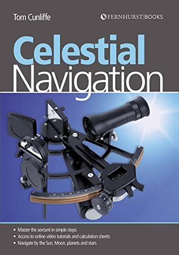
Front cover image: TAMAYA TECHNICS INC.
Auszug. � Genehmigter Nachdruck. Alle Rechte vorbehalten.
Celestial Navigation
By Tom CunliffeJohn Wiley & Sons
Copyright � 2010 John Wiley & Sons, LtdAll right reserved.
ISBN: 978-0-470-66633-3
Chapter One
The Earth and the Heavens
We all learn as infants that the Earth revolves once a day and that the stars remain, to a greater or lesser extent, stationary. We also become aware that the Moon is in our own back yard, that the stars are plunging through space at various mind-boggling distances from us and that the Earth is travelling on an annual voyage around the Sun. Whether or not all this is true is of no relevance to the practical astro navigator.
For our purposes the Earth, otherwise known as the terrestrial sphere, may be taken to be a perfectly round ball swimming in a vacuum at the centre of the known universe. At the outside of the vacuum, an indeterminate but fortunately irrelevant distance away, is a further big ball which marks the perimeter of the universe. This ball is known as the celestial sphere. For our purposes all the heavenly bodies move in their courses on its inside surface, and its centre coincides exactly with the centre of the Earth.
THE TERRESTRIAL SPHERE
Any location on the Earth's surface can be expressed in terms of latitude and longitude.
Meridians of longitude
To define our position on the globe in an eastwest direction we make use of the meridians of longitude. These are great circles which converge at the poles of the Earth, a great circle being the line described on the Earth's surface by a plane passing through the centre of the Earth. In the case of a meridian, it is best thought of as what you would see if you pulled a segment out of a perfectly round orange. The segment starts and ends at the opposite poles of the orange. Its curved surface is the shortest distance between them on the surface of the orange. This definition becomes more important when great circle sailing is discussed later. For now, it is enough that a meridian runs direct from pole to pole on the surface of the terrestrial sphere.
Position is measured in terms of angular distance (see below) east or west of the zero or datum meridian. This passes through the Greenwich Observatory in England, and is known as the Greenwich Meridian. Those in denial of Britain's contribution to astronomy and longitude can choose to call this the International Reference Meridian, or the Prime Meridian. Longitude is measured in degrees east or west of Greenwich until east and west meet somewhere in the remote Pacific Ocean.
Parallels of latitude
Having determined our angular distance east or west of Greenwich we need another set of co-ordinates to fix us in a north–south direction. These are the parallels of latitude, which define angular distance north or south of the equator, which is actually the great circle on a plane at right angles to the Earth's axis, halfway between two poles.
The equator is the only parallel of latitude which fulfils the definition of a great circle. All the others are small circles (see diagram).
Geographic position
Any point on the Earth's surface fixed by its terrestrial co-ordinates (latitude and longitude), is known as a geographic position (GP).
Angular distance
For the non-specialist, distances between locations on Earth are generally expressed in miles or kilometres. This is convenient because we need to time our journeys. For the astro navigator, things are somewhat different. It would be impossible to try to handle the north–south distance between the stars Sirius and Aldebaran in terms of miles, but to say that it is 33� measured from the centre of the Earth is comprehensible and very easy to work with.
When dealing with spheres, the most convenient unit of distance is one degree of a circle. The Earth turns through around 25,000 miles in a 24-hour day at the equator. Because the meridians come together at the pole, it won't be anything like this far in Northern Norway. This inconvenience is done away with if we think of Earth as turning through 360 degrees in a day. This is angular distance. It's the same in Norway, the Caribbean and even for a masochist camped out a few yards from the North Pole.
Subdivision of degrees
A degree subdivides into 60 minutes (60), and each minute into 60 seconds (60). One minute of latitude is equal, at all latitudes, to one nautical mile (1M). One second of latitude is equal to 101 feet, or a few boat lengths for the average yacht. Since this is clearly too small to be of any serious use, minutes of arc are now more conveniently subdivided into decimal points, thus: 36�14.1N. A tenth of a mile is around 200 yards, the length of a unit of anchor rode in Nelson's navy, hence the term 'cable' when used for distance.
One minute of longitude equals one mile at the equator, but diminishes to zero at the poles. Working out what it represents in between in terms of miles would mean yet another calculation, so there, straight away, is a very good reason for the concept of angular distance.
THE CELESTIAL SPHERE
Just as it is possible to fix a position on the Earth's surface using its terrestrial co-ordinates of latitude and longitude, so the exact situation of a heavenly body on the surface of the celestial sphere can be defined by its celestial co-ordinates.
All the main features of the terrestrial sphere are mirrored in its celestial counterpart.
The terrestrial poles, if projected outwards from the centre of the Earth onto the celestial sphere, form the celestial poles. The terrestrial equator is projected outwards to throw a great circle onto the celestial sphere equidistant at all points from the celestial poles. This is called the celestial equator.
Celestial longitude – or Greenwich Hour Angle (GHA)
Since the first edition of this book, the notion of Greenwich Mean Time (GMT) has been replaced by Universal Time (UT). Modern almanacs and data in general refer nowadays to UT, but Greenwich remains the centre of operations for the celestial navigator. As for time alone, there is no practical difference between the two.
The celestial zero meridian is the projection of the terrestrial zero (Greenwich) meridian. However, whereas terrestrial longitude is measured from the Greenwich Meridian in degrees east or west around the world to 180 on the opposite side, celestial longitude, which is known as Greenwich Hour Angle (GHA), is measured to the westward only in degrees from 0 to 360�. When considering matters concerning the concept of Greenwich Hour Angle, never forget that it is merely a way of expressing celestial longitude.
You will see in the diagram on page 4 that 40�W longitude is the equivalent of a GHA of 40� on the celestial sphere, and that 120�E longitude marries up with GHA 240�. A second glance shows that if 120E were expressed in a 0� to 360� notation, beginning at Greenwich and working westward, it would represent a longitude of 240�. It is just a question of convention. For better or worse, longitude is expressed as 0� to 180� east or west, and GHA as 0� to 360�.
To convert east longitude to 360� notation and tie it in with the corresponding GHA, simply subtract the figure from 360�. Thus 120� east is equivalent to a GHA of 360 minus 120, or 240�.
To find the GHA of a body for a given time (and it changes by the second as the Earth turns) you need to consult...
��ber diesen Titel� kann sich auf eine andere Ausgabe dieses Titels beziehen.
Weitere beliebte Ausgaben desselben Titels

Suchergebnisse f�r Celestial Navigation: Learn How to Master One of the...

Beispielbild f�r diese ISBN
Celestial Navigation Learn Ho
Anbieter: World of Books (was SecondSale), Montgomery, IL, USA
Verk�uferbewertung 5 von 5 Sternen
![]()
Zustand: Good. Item in good condition. Textbooks may not include supplemental items i.e. CDs, access codes etc. Artikel-Nr. 00102587792
Gebraucht kaufen
EUR 6,71
Versand gratis
Versand innerhalb von USA
Versand innerhalb von USA
Anzahl: 1 verf�gbar
Beispielbild f�r diese ISBN
Celestial Navigation: Learn How to Master One of the Oldest Mariner's Arts
Verlag:
Fernhurst Books (edition 3), 2010
ISBN 10: 0470666331
ISBN 13: 9780470666333
Gebraucht
Paperback
Anbieter: BooksRun, Philadelphia, PA, USA
Verk�uferbewertung 5 von 5 Sternen
![]()
Paperback. Zustand: Very Good. 3. It's a well-cared-for item that has seen limited use. The item may show minor signs of wear. All the text is legible, with all pages included. It may have slight markings and/or highlighting. Artikel-Nr. 0470666331-11-1
Gebraucht kaufen
EUR 8,99
Versand gratis
Versand innerhalb von USA
Versand innerhalb von USA
Anzahl: 1 verf�gbar
Beispielbild f�r diese ISBN
Celestial Navigation: The Essential Guide for Every Sailor - Learn How to Master One of the Oldest Mariner's Arts
Anbieter: Books From California, Simi Valley, CA, USA
Verk�uferbewertung 4 von 5 Sternen
![]()
Paperback. Zustand: Very Good. Cover and edges may have some wear. Artikel-Nr. mon0004036324
Gebraucht kaufen
EUR 5,63
EUR 4,26 Versand
Versand innerhalb von USA
Versand innerhalb von USA
Anzahl: 2 verf�gbar
Beispielbild f�r diese ISBN
Celestial Navigation: Learn How to Master One of the Oldest Mariner's Arts
Verlag:
Fernhurst Books (edition 3), 2010
ISBN 10: 0470666331
ISBN 13: 9780470666333
Gebraucht
Paperback
Anbieter: BooksRun, Philadelphia, PA, USA
Verk�uferbewertung 5 von 5 Sternen
![]()
Paperback. Zustand: Very Good. 3. It's a well-cared-for item that has seen limited use. The item may show minor signs of wear. All the text is legible, with all pages included. It may have slight markings and/or highlighting. Artikel-Nr. 0470666331-8-1
Gebraucht kaufen
EUR 12,36
Versand gratis
Versand innerhalb von USA
Versand innerhalb von USA
Anzahl: 1 verf�gbar
Beispielbild f�r diese ISBN
Celestial Navigation
Anbieter: PBShop.store US, Wood Dale, IL, USA
Verk�uferbewertung 5 von 5 Sternen
![]()
PAP. Zustand: New. New Book. Shipped from UK. Established seller since 2000. Artikel-Nr. FW-9780470666333
Beispielbild f�r diese ISBN
Celestial Navigation
Anbieter: PBShop.store UK, Fairford, GLOS, Vereinigtes K�nigreich
Verk�uferbewertung 5 von 5 Sternen
![]()
PAP. Zustand: New. New Book. Shipped from UK. Established seller since 2000. Artikel-Nr. FW-9780470666333
Neu kaufen
EUR 14,14
EUR 3,80 Versand
Versand von Vereinigtes K�nigreich nach USA
Versand von Vereinigtes K�nigreich nach USA
Anzahl: 15 verf�gbar
Beispielbild f�r diese ISBN
Celestial Navigation �" Learn How to Master One of the Oldest Mariner`s Arts
Anbieter: WorldofBooks, Goring-By-Sea, WS, Vereinigtes K�nigreich
Verk�uferbewertung 5 von 5 Sternen
![]()
Paperback. Zustand: Very Good. The book has been read, but is in excellent condition. Pages are intact and not marred by notes or highlighting. The spine remains undamaged. Artikel-Nr. GOR004857720
Gebraucht kaufen
EUR 11,75
EUR 6,70 Versand
Versand von Vereinigtes K�nigreich nach USA
Versand von Vereinigtes K�nigreich nach USA
Anzahl: 1 verf�gbar
Beispielbild f�r diese ISBN
Celestial Navigation
Anbieter: Majestic Books, Hounslow, Vereinigtes K�nigreich
Verk�uferbewertung 4 von 5 Sternen
![]()
Zustand: New. pp. 65. Artikel-Nr. 6448026
Neu kaufen
EUR 15,46
EUR 7,50 Versand
Versand von Vereinigtes K�nigreich nach USA
Versand von Vereinigtes K�nigreich nach USA
Anzahl: 3 verf�gbar
Beispielbild f�r diese ISBN
Celestial Navigation Learn How to Master One of the Oldest Mariner`s Arts
Anbieter: Revaluation Books, Exeter, Vereinigtes K�nigreich
Verk�uferbewertung 5 von 5 Sternen
![]()
Paperback. Zustand: Brand New. 3rd revised updated edition. 65 pages. 9.50x6.75x0.25 inches. In Stock. Artikel-Nr. __0470666331
Neu kaufen
EUR 13,17
EUR 11,54 Versand
Versand von Vereinigtes K�nigreich nach USA
Versand von Vereinigtes K�nigreich nach USA
Anzahl: 2 verf�gbar
Beispielbild f�r diese ISBN
Celestial Navigation: Learn How to Master One of the Oldest Mariner's Arts
Anbieter: Ria Christie Collections, Uxbridge, Vereinigtes K�nigreich
Verk�uferbewertung 5 von 5 Sternen
![]()
Zustand: New. In. Artikel-Nr. ria9780470666333_new
Neu kaufen
EUR 13,85
EUR 13,83 Versand
Versand von Vereinigtes K�nigreich nach USA
Versand von Vereinigtes K�nigreich nach USA
Anzahl: Mehr als 20 verf�gbar