
Verwandte Artikel zu The Mapmakers
Inhaltsangabe
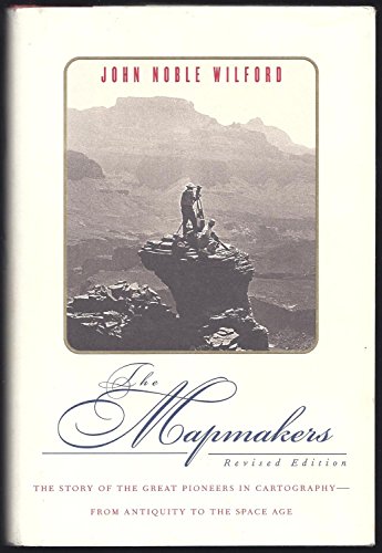
A revised edition of the classic history of cartography spans the period of time from when maps were first made on clay tablets, to the Space Age, when satellites map the universe, and examines the technical ingenuity by which mapmakers charted the surfce of the planet, Earth's interior and the ocean floors, and the moons and planets of the solar system. 15,000 first printing.
Die Inhaltsangabe kann sich auf eine andere Ausgabe dieses Titels beziehen.
Auszug. © Genehmigter Nachdruck. Alle Rechte vorbehalten.
Preface
Who has not spread out a map on the table and felt its promise of places to go and things to see and do? Ah, so that's Zanzibar, a real place, as real as Dar es Salaam across this stretch of blue or Timbuktu up there in the emptiness of the Sahara. Let's see, we could cross at Dunkerque, here (so this is where it happened, the glorious retreat), and be in London, there, first thing the next morning. Now, here's the plan: we sail from Philipsburg, here, out across the Anegada Passage and put in at Road Town, over here on Tortola. Look at these names, will you -- Oodnadatta, Ilbunga, Rumbalara, Bundooma, Rodinga, Alice Springs -- you can almost see the lonely cattle stations, the dingoes and kangaroos, the dusty ringers drinking beer at some forlorn pub known as the Southern Cross. And look at this speck of land, Bouvet Island, several thousand kilometers from the tip of South Africa, where no one lives and few people have ever set foot; yet here it is on the map, inviting dreams, speculations, perhaps exploration.
Joseph Conrad understood this feeling. In Heart of Darkness, Conrad has Marlow saying: "Now when I was a little chap I had a passion for maps. I would look for hours at South America, or Africa, or Australia, and lose myself in all the glories of exploration. At that time there were many blank spaces on the earth, and when I saw one that looked particularly inviting on a map (but they all look that) I would put my finger on it and say, 'When I grow up I will go there.' "
Who does not have etched in the mind images of countries and of the world based on maps? Until recent times, indeed, the world was more familiar to us as a map than in reality. As he approached the end of his flight in Earth orbit in 1962, John H. Glenn remarked: "I can see the whole state of Florida just laid out like on a map." A number of astronauts, and then all of us who saw the photography from space, marveled at how much the Florida peninsula, the meandering Mississippi, the islands of Britain, the boot of Italy, or any of the geographical shapes resembled the maps everyone had grown up with. We had taken it for granted that maps were faithful reflections of reality; yet we were somehow amazed when reality turned out to be true to the maps.
This reaction is an unspoken tribute to the mapmakers, past and present. Speak of any beckoning new land, and there have always been people setting forth, the Lewises and Clarks and the Frémonts, to map and incorporate the new world into the mind of the old. Speak of the remaining unknowns, and there are the ships setting out to take a seismic or sonic measure of the ocean floor and thereby map it, or the spaceships embarking to map the Moon, Venus, Mars, and the satellites of Jupiter. Speak of anything spatial, and there was, is, or will be a mapmaker seeking to make it more understandable through a mosaic of points, symbols, lines, shadings, and coloring -- that is, through a map.
But who are these people who make the maps that touch the little chap in us all? How did the art and science of mapmaking evolve? Who were the important pioneers in developing the map as one of the most useful forms of human communication? These are the questions addressed in this book. For this is the story of how Earth and then Earth's nearest neighbors came to be mapped.
It is a story with a multitude of diverse characters: scholars and scientists, soldiers and sea captains, explorers and adventurers, monks and clockmakers, schoolteachers and spies, aviators and technicians, rich men and poor, those who stand out in history and those who are generally forgotten. They were chosen for inclusion in this book because of achievements that promoted (or in a few cases, hindered) the development of certain important types of mapping or that illustrated the expanding reach and growing precision of cartography.
It is a very human story of heroics and everyday routine, of personal and national rivalries, of influential mistakes and brilliant insights, of technological innovation and a passion to explore and understand Earth and the universe.
Parts of the story have, of course, been told before, and without such earlier scholarship this book would not have been possible. But the story of the mapmakers in its full historical sweep seems to have been neglected. Antiquarians publish handsome portfolios of old maps, but treat them more as objects of admiration and preservation than as products of a fascinating history. The many atlases provide ample evidence of cartographic achievement, but little of how it was done. Historians write volumes about the explorations of new worlds, but usually regard the cartographic aspects as incidental to the political, economic, or adventure themes. The few historians of geography and cartography seem to be more interested in the maps themselves than in the people who went into the field, often at great risk, to get the information communicated through maps; moreover, most of these historians, in their writings, stop short of the tremendous advances in maps and mapping of the twentieth century. And, unfortunately, professional mappers themselves, the surveyors and cartographers, have seldom seen fit to write of their work except in the bloodless language of the specialized journals.
I was inspired to attempt a fuller account of maps and the mapmakers -- of cartography and its allied science, geodesy -- after working with a mapping party in the Grand Canyon. To see how much hard work and new technology went into mapmaking was a revelation. To consider how much more difficult the task must have been in earlier times aroused my curiosity about the pioneering mapmakers. I shall always be grateful to Bradford Washburn, director of the Museum of Science in Boston and leader of the Grand Canyon mapping party, for introducing me to the Canyon and to cartography.
As I learned during subsequent research, this is an appropriate time in history to tell the story of the mapmakers. For only now, at the end of the twentieth century, can it be said that Earth has been mapped, though not always well or everywhere completely. The first two parts of the book are devoted to the broad trends and signal achievements of cartography and geodesy prior to the twentieth century. The final two parts include some earlier history but are focused on the twentieth century, a time of new technologies, when so much that was once thought unmappable has come to be mapped.
Preface to the Revised Edition
While I was on a visit to the Library of Congress in 1997, it struck me that the time had come to update and expand this book, first published in 1981. The old maps on the shelves and in the vaults of the library's Geography and Map Division, repository of the world's largest collection of maps and atlases (4,600,000 map sheets, 60,000 atlases, and 300 globes), pulled me again into cartography's rich past. I admired a twelve-volume set of maps printed and hand-painted by the Blaeu family in the golden age of Dutch cartography in the sixteenth and seventeenth centuries. Here, too, were a 1607 vellum map of Samuel de Champlain's explorations of North America and Pierre L'Enfant's original 1791 plan for the new capital city of Washington, with Thomas Jefferson's handwritten changes.
The reading room snapped me back into the present. A couple of young men were hunched before computer screens, scrutinizing a map their fingers had just commanded into existence. The map could show them the trail to a trout stream in the mountains, the streets of their neighborhood, or the incidence of cancer by county in any particular state. The map could be ephemeral, vanishing at the next click on the keyboard. It could be altered on the screen -- details added or highlighted, scale and perspective changed -- and then printed out. Someone...
„Über diesen Titel“ kann sich auf eine andere Ausgabe dieses Titels beziehen.
Suchergebnisse für The Mapmakers

Beispielbild für diese ISBN
The Mapmakers, Revised Edition
Anbieter: World of Books (was SecondSale), Montgomery, IL, USA
Verkäuferbewertung 5 von 5 Sternen

Zustand: Good. Item in good condition. Textbooks may not include supplemental items i.e. CDs, access codes etc. Artikel-Nr. 00100409062
Gebraucht kaufen
EUR 4,30
Versand gratis
Versand innerhalb von USA
Versand innerhalb von USA
Anzahl: 3 verfügbar
Beispielbild für diese ISBN
The Mapmakers, Revised Edition
Anbieter: Hot from the Toaster, Portland, OR, USA
Verkäuferbewertung 5 von 5 Sternen
Hardcover. Zustand: Very Good. Zustand des Schutzumschlags: As New. former library book. Artikel-Nr. ABE-1786131239593
Gebraucht kaufen
EUR 4,42
Versand gratis
Versand innerhalb von USA
Versand innerhalb von USA
Anzahl: 1 verfügbar
Beispielbild für diese ISBN
The Mapmakers, Revised Edition
Anbieter: ThriftBooks-Atlanta, AUSTELL, GA, USA
Verkäuferbewertung 5 von 5 Sternen
Hardcover. Zustand: Good. No Jacket. Missing dust jacket; Pages can have notes/highlighting. Spine may show signs of wear. ~ ThriftBooks: Read More, Spend Less. Artikel-Nr. G0375409297I3N01
Gebraucht kaufen
EUR 5,73
Versand gratis
Versand innerhalb von USA
Versand innerhalb von USA
Anzahl: 1 verfügbar
Beispielbild für diese ISBN
The Mapmakers, Revised Edition
Anbieter: ThriftBooks-Dallas, Dallas, TX, USA
Verkäuferbewertung 5 von 5 Sternen
Hardcover. Zustand: Fair. No Jacket. Missing dust jacket; Readable copy. Pages may have considerable notes/highlighting. ~ ThriftBooks: Read More, Spend Less. Artikel-Nr. G0375409297I5N01
Gebraucht kaufen
EUR 5,73
Versand gratis
Versand innerhalb von USA
Versand innerhalb von USA
Anzahl: 1 verfügbar
Foto des Verkäufers
The Mapmakers, Revised Edition
Anbieter: Dream Books Co., Denver, CO, USA
Verkäuferbewertung 5 von 5 Sternen
Zustand: acceptable. This copy has clearly been enjoyedâ"expect noticeable shelf wear and some minor creases to the cover. Binding is strong, and all pages are legible. May contain previous library markings or stamps. Artikel-Nr. DBV.0375409297.A
Gebraucht kaufen
EUR 6,59
Versand gratis
Versand innerhalb von USA
Versand innerhalb von USA
Anzahl: 1 verfügbar
Beispielbild für diese ISBN
The Mapmakers
Verlag:
Knopf Doubleday Publishing Group, 2000
ISBN 10: 0375409297
ISBN 13: 9780375409295
Gebraucht
Hardcover
Anbieter: Better World Books: West, Reno, NV, USA
Verkäuferbewertung 5 von 5 Sternen
Zustand: Very Good. rev Edition. Pages intact with possible writing/highlighting. Binding strong with minor wear. Dust jackets/supplements may not be included. Stock photo provided. Product includes identifying sticker. Better World Books: Buy Books. Do Good. Artikel-Nr. 470576-6
Gebraucht kaufen
EUR 8,67
Versand gratis
Versand innerhalb von USA
Versand innerhalb von USA
Anzahl: 1 verfügbar
Beispielbild für diese ISBN
The Mapmakers
Verlag:
Knopf Doubleday Publishing Group, 2000
ISBN 10: 0375409297
ISBN 13: 9780375409295
Gebraucht
Hardcover
Anbieter: Better World Books, Mishawaka, IN, USA
Verkäuferbewertung 5 von 5 Sternen
Zustand: Very Good. rev Edition. Pages intact with possible writing/highlighting. Binding strong with minor wear. Dust jackets/supplements may not be included. Stock photo provided. Product includes identifying sticker. Better World Books: Buy Books. Do Good. Artikel-Nr. 470576-6
Gebraucht kaufen
EUR 10,50
Versand gratis
Versand innerhalb von USA
Versand innerhalb von USA
Anzahl: 1 verfügbar
Beispielbild für diese ISBN
The Mapmakers
Verlag:
Knopf Doubleday Publishing Group, 2000
ISBN 10: 0375409297
ISBN 13: 9780375409295
Gebraucht
Hardcover
Anbieter: Better World Books, Mishawaka, IN, USA
Verkäuferbewertung 5 von 5 Sternen
Zustand: Good. rev Edition. Pages intact with minimal writing/highlighting. The binding may be loose and creased. Dust jackets/supplements are not included. Stock photo provided. Product includes identifying sticker. Better World Books: Buy Books. Do Good. Artikel-Nr. GRP102344064
Gebraucht kaufen
EUR 10,50
Versand gratis
Versand innerhalb von USA
Versand innerhalb von USA
Anzahl: 1 verfügbar
Beispielbild für diese ISBN
The Mapmakers; revised edition
Verlag:
Alfred A. Knopf, New York, 2000
ISBN 10: 0375409297
ISBN 13: 9780375409295
Gebraucht
Hardcover
Anbieter: Argosy Book Store, ABAA, ILAB, New York, NY, USA
Verkäuferbewertung 5 von 5 Sternen
hardcover. Zustand: near fine. Zustand des Schutzumschlags: very good. 507 pages, black and white imagery (some full page), 8vo, 3/4 off-white cloth boards, (red spine, silver embossed title on spine), d.w. (minor scuffing on back). A fine copy with a good (-) dust wrapper. Alfred A. Knopf Publisher, New York (2000). Ink signature of previous owner. Artikel-Nr. 323956
Gebraucht kaufen
EUR 14,92
EUR 5,15 Versand
Versand innerhalb von USA
Versand innerhalb von USA
Anzahl: 1 verfügbar
Foto des Verkäufers
The Mapmakers, Revised Edition
Verlag:
Alfred A. Knopf, 2000
ISBN 10: 0375409297
ISBN 13: 9780375409295
Gebraucht
Hardcover
Erstausgabe
Anbieter: Southampton Books, Sag Harbor, NY, USA
Verkäuferbewertung 5 von 5 Sternen
Hardcover. Zustand: Like New. First Edition. First Edition, First Printing. Published by Alfred A. Knopf, 2000. Octavo. Hardcover. Book is like new. Dust jacket is like new. Artikel-Nr. 516738
Gebraucht kaufen
EUR 17,68
EUR 4,28 Versand
Versand innerhalb von USA
Versand innerhalb von USA
Anzahl: 1 verfügbar