Verwandte Artikel zu Canterbury and East Kent, Dover and Margate: Sheet...
Zu dieser ISBN ist aktuell kein Angebot verf�gbar.
Alle Exemplare der Ausgabe mit dieser ISBN anzeigen:
Rese�a del editor:
This map is part of the Landranger (Pink) series and is designed for people who really want to get to know an area. It includes the following information: tourist information, camping and caravan sites, picnic areas and viewpoints, selected places of interest and rights of way information for England and Wales. Each map in the series covers an area of 40 km by 40 km (25 miles by 25 miles) and like other Ordnance Survey maps, National Grid squares are provided so that any feature can be given a unique reference number. Perfect for planning ahead and local excursions, these maps are full of useful information that will help you really get to know an area.
Biograf�a del autor:
Ordnance Survey is Britain's national mapping agency, responsible for the official, definitive mapping of the whole country. They produce and market a wide range of maps for educational and leisure purposes, as well as producing computer data products for government, business and administrative use.
��ber diesen Titel� kann sich auf eine andere Ausgabe dieses Titels beziehen.
- VerlagOrdnance Survey
- Erscheinungsdatum1998
- ISBN 10 0319223272
- ISBN 13 9780319223277
- EinbandMapa
Beste Suchergebnisse beim ZVAB

Beispielbild f�r diese ISBN
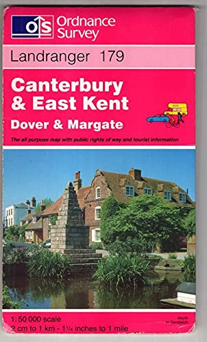
Canterbury and East Kent, Dover and Margate: Sheet 179 (Landranger Maps)
Anbieter:
Bewertung
Buchbeschreibung Paperback. Zustand: Very Good. The book has been read, but is in excellent condition. Pages are intact and not marred by notes or highlighting. The spine remains undamaged. Artikel-Nr. GOR002970372
Weitere Informationen zu diesem Verk�ufer | Verk�ufer kontaktieren
Gebraucht kaufen
EUR 2,14
W�hrung umrechnen
Foto des Verk�ufers
Landranger 179 : Canterbury and East Kent, Dover and Margate.
Verlag:
Southhampton : Ordnance Survey
(1998)
ISBN 10: 0319223272
ISBN 13: 9780319223277
Gebraucht
Anzahl: 1
Anbieter:
Bewertung
Buchbeschreibung Faltkarte. Zustand: Gut. Edition C, repr. w. correct. 1 Kt. Einbd. leicht berieben/etw. besto�en, ansonsten sehr gut erh. ISBN: 9780319223277 Sprache: Englisch Gewicht in Gramm: 130. Artikel-Nr. 91224
Weitere Informationen zu diesem Verk�ufer | Verk�ufer kontaktieren
Gebraucht kaufen
EUR 18,00
W�hrung umrechnen