War maps: World War II, from September 1939 to August 1945, air, sea, and land, battle by battle - Hardcover
Inhaltsangabe
War Maps - This 192-page hardcover was published in 1982 by St. Martin's Press (1st US edition).
Die Inhaltsangabe kann sich auf eine andere Ausgabe dieses Titels beziehen.
Weitere beliebte Ausgaben desselben Titels

Suchergebnisse f�r War maps: World War II, from September 1939 to August...

Beispielbild f�r diese ISBN
War maps: World War II, from September 1939 to August 1945, air, sea, and land, battle by battle
Anbieter: ThriftBooks-Atlanta, AUSTELL, GA, USA
Verk�uferbewertung 5 von 5 Sternen
![]()
Hardcover. Zustand: Good. No Jacket. Pages can have notes/highlighting. Spine may show signs of wear. ~ ThriftBooks: Read More, Spend Less. Artikel-Nr. G0312855842I3N00
Gebraucht kaufen
EUR 6,01
Versand gratis
Versand innerhalb von USA
Versand innerhalb von USA
Anzahl: 1 verf�gbar
Beispielbild f�r diese ISBN
War maps: World War II, from September 1939 to August 1945, air, sea, and land, battle by battle
Anbieter: ThriftBooks-Atlanta, AUSTELL, GA, USA
Verk�uferbewertung 5 von 5 Sternen
![]()
Hardcover. Zustand: Good. No Jacket. Missing dust jacket; Pages can have notes/highlighting. Spine may show signs of wear. ~ ThriftBooks: Read More, Spend Less. Artikel-Nr. G0312855842I3N01
Gebraucht kaufen
EUR 6,01
Versand gratis
Versand innerhalb von USA
Versand innerhalb von USA
Anzahl: 1 verf�gbar
Beispielbild f�r diese ISBN
War maps: World War II, from September 1939 to August 1945, air, sea, and land, battle by battle
Anbieter: ThriftBooks-Reno, Reno, NV, USA
Verk�uferbewertung 5 von 5 Sternen
![]()
Hardcover. Zustand: Good. No Jacket. Missing dust jacket; Pages can have notes/highlighting. Spine may show signs of wear. ~ ThriftBooks: Read More, Spend Less. Artikel-Nr. G0312855842I3N01
Gebraucht kaufen
EUR 6,01
Versand gratis
Versand innerhalb von USA
Versand innerhalb von USA
Anzahl: 1 verf�gbar
Beispielbild f�r diese ISBN
War maps: World War II, from September 1939 to August 1945, air, sea, and land, battle by battle
Anbieter: ThriftBooks-Dallas, Dallas, TX, USA
Verk�uferbewertung 5 von 5 Sternen
![]()
Hardcover. Zustand: Fair. No Jacket. Readable copy. Pages may have considerable notes/highlighting. ~ ThriftBooks: Read More, Spend Less. Artikel-Nr. G0312855842I5N00
Gebraucht kaufen
EUR 6,01
Versand gratis
Versand innerhalb von USA
Versand innerhalb von USA
Anzahl: 1 verf�gbar
Beispielbild f�r diese ISBN
War maps: World War II, from September 1939 to August 1945, air, sea, and land, battle by battle
Anbieter: Wonder Book, Frederick, MD, USA
Verk�uferbewertung 5 von 5 Sternen
![]()
Zustand: Good. Good condition. Good dust jacket. A copy that has been read but remains intact. May contain markings such as bookplates, stamps, limited notes and highlighting, or a few light stains. Artikel-Nr. L09C-04814
Gebraucht kaufen
EUR 7,20
Versand gratis
Versand innerhalb von USA
Versand innerhalb von USA
Anzahl: 2 verf�gbar
Beispielbild f�r diese ISBN
War Maps
Verlag:
St. Martin's Press, 1983
ISBN 10: 0312855842
ISBN 13: 9780312855840
Gebraucht
Hardcover
Erstausgabe
Anbieter: Better World Books, Mishawaka, IN, USA
Verk�uferbewertung 5 von 5 Sternen
![]()
Zustand: Good. First Edition. Pages intact with minimal writing/highlighting. The binding may be loose and creased. Dust jackets/supplements are not included. Stock photo provided. Product includes identifying sticker. Better World Books: Buy Books. Do Good. Artikel-Nr. 3187293-6
Gebraucht kaufen
EUR 8,73
Versand gratis
Versand innerhalb von USA
Versand innerhalb von USA
Anzahl: 1 verf�gbar
Beispielbild f�r diese ISBN
War Maps
Verlag:
St. Martin's Press, 1983
ISBN 10: 0312855842
ISBN 13: 9780312855840
Gebraucht
Hardcover
Erstausgabe
Anbieter: Better World Books, Mishawaka, IN, USA
Verk�uferbewertung 5 von 5 Sternen
![]()
Zustand: Very Good. First Edition. Pages intact with possible writing/highlighting. Binding strong with minor wear. Dust jackets/supplements may not be included. Stock photo provided. Product includes identifying sticker. Better World Books: Buy Books. Do Good. Artikel-Nr. 10149720-75
Gebraucht kaufen
EUR 8,73
Versand gratis
Versand innerhalb von USA
Versand innerhalb von USA
Anzahl: 1 verf�gbar
Beispielbild f�r diese ISBN
War Maps
Anbieter: WeBuyBooks, Rossendale, LANCS, Vereinigtes K�nigreich
Verk�uferbewertung 5 von 5 Sternen
![]()
Zustand: Good. Most items will be dispatched the same or the next working day. A copy that has been read but remains in clean condition. All of the pages are intact and the cover is intact and the spine may show signs of wear. The book may have minor markings which are not specifically mentioned. Artikel-Nr. rev1814960222
Gebraucht kaufen
EUR 14,95
EUR 12,93 Versand
Versand von Vereinigtes K�nigreich nach USA
Versand von Vereinigtes K�nigreich nach USA
Anzahl: 1 verf�gbar
Beispielbild f�r diese ISBN
War Maps; World War II, from September 1939 to August 1945, air, sea and land, battle by battle
Verlag:
St. Martin's Press, New York, 1982
ISBN 10: 0312855842
ISBN 13: 9780312855840
Gebraucht
Hardcover
Erstausgabe
Anbieter: Ground Zero Books, Ltd., Silver Spring, MD, USA
Verk�uferbewertung 5 von 5 Sternen
![]()
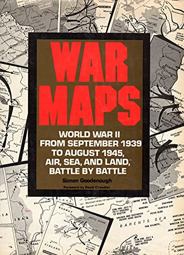
Hardcover. Zustand: Very good. Zustand des Schutzumschlags: Good. Format is approximately 9.25 inches by 12 inches. 191, [1] pages. DJ has wear, tears and soiling. Foreword by David Chandler. 232 Maps (many with color). Illustrations (some in color). Bibliography. Index. A guide to World War II's major campaigns maps all crucial land, sea, and air confrontations, plotting troop and equipment deployments for each battle and campaign. This book details the crucial land, sea and air confrontations of the Second World War in a series of self-contained full color spreads. The major sections are: War in Europe, The War in North Africa, The War in Italy, The Russian Front, The Allied Invasion of North-West Europe, and The War in the Orient. Military Cartography has been a major, and an evolving, military discipline since ground forces wondered what was beyond the next hill. Since the Napoleonic Wars (at least), military map-making has been a major activity of the technical staff. Cartographic organizations have been created. For example, the major task of the Army Map Service was the compilation, publication and distribution of military topographic maps and related products required by the Armed Forces of the United States. The AMS was also involved in the preparation of extraterrestrial maps of satellite and planetary bodies; the preparation of national intelligence studies; the establishment of world geodetic control networks by both satellite and conventional triangulation methods; and the logistic military planning of Corps of Engineer items. Another major responsibility of the AMS was to maintain the largest geodetic and topographic data libraries for the Department of Defense. The Army Map Service (AMS) was the military cartographic agency of the United States Department of Defense from 1941 to 1968, subordinated to the United States Army Corps of Engineers. First U.S. Edition [stated]. First printing [stated]. Artikel-Nr. 82475
Gebraucht kaufen
EUR 45,02
EUR 4,37 Versand
Versand innerhalb von USA
Versand innerhalb von USA
Anzahl: 1 verf�gbar