
Verwandte Artikel zu From Sails to Satellites: The Origin and Development...
Inhaltsangabe
When Hipparchus invented the coordinate system of latitude and longitude, a rough latitude could be found, at least on land, with solar measurements, but it would take another two thousand years before longitude could be measured accurately at sea. Indeed, before the perfection of the sextant and chronometer in the 18th century, sailors navigated on long voyages without knowing where they were for much of the time. In 1991, in contrast, single-seater pest-spraying aircraft in the Sahara Desert routinely fixed their position with an accuracy of thirty yards using the Navstar Global Positioning System (GPS). The Navstar system, which employs 18 satellites around the earth, even boasts hand-held models costing less than a thousand dollars, within the budget of most weekend sailors.
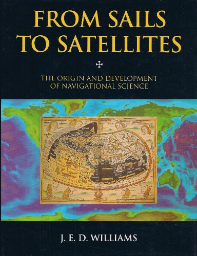
From Sails to Satellites traces the history of navigational science from the earliest systems of dead reckoning, to astrolabes and cross-staffs, to the ultra-modern guidance systems used by planes, ships, and missiles. Williams recounts the two-hundred-year Great Pursuit of Longitude, ranging from 1598, when Philip III of Spain offered lavish prizes for its discovery (and ironically brushed off Galileo, the only person alive who was on the right track); to 1759, when the most famous marine chronometer of all time, chronometer No. 4 built by John Harrison, a Yorkshire carpenter turned clockmaker, accurately measured longitude; to the development of the sextant, the first practical way to measure longitude. Williams discusses how in the 19th century great strides were made in the perfection of the pivoted needle compass, in nautical astronomy, in tidal prediction, and in marine lights, but it was with the Wright Brother's successful flight that navigation once again moved to the front ranks of science. He reveals how even as the first airplane flew in Kitty Hawk, scientists in America and Italy were developing radio direction-finding, while in Germany Anschutz-Kaempfe was developing the first gyrocompass and Hulsmeyer was preparing to file the first radar patent. And Williams brings the story completely up to the moment with descriptions of radar, inertial navigation systems, lasers, and much more.
A fascinating narrative which skillfully interweaves the threads of science, trade, exploration, and warfare, From Sails to Satellites is written with care and insight by an author who has more than 50 years' experience of and curiosity about the human need to know position and course. It will intrigue anyone who has ever navigated a sailboat or a Cesna, and readers interested in the history of science and technology.
Die Inhaltsangabe kann sich auf eine andere Ausgabe dieses Titels beziehen.
Über die Autorin bzw. den Autor
About the Author:
J.E.D. Williams has been Chief Navigator of Argentine Airlines and El Al Airlines, the managing director of Britannia Airways, and a past president of the Royal Institute of Navigation.
„Über diesen Titel“ kann sich auf eine andere Ausgabe dieses Titels beziehen.
Suchergebnisse für From Sails to Satellites: The Origin and Development...

Beispielbild für diese ISBN
From Sails to Satellites: The Origin and Development of Navigational Science
Verlag:
Oxford University Press (edition ), 1993
ISBN 10: 0198563876
ISBN 13: 9780198563877
Gebraucht
Hardcover
Anbieter: BooksRun, Philadelphia, PA, USA
Verkäuferbewertung 5 von 5 Sternen

Hardcover. Zustand: Very Good. With dust jacket. It's a well-cared-for item that has seen limited use. The item may show minor signs of wear. All the text is legible, with all pages included. It may have slight markings and/or highlighting. Artikel-Nr. 0198563876-11-1-29
Gebraucht kaufen
EUR 6,77
Versand gratis
Versand innerhalb von USA
Versand innerhalb von USA
Anzahl: 1 verfügbar
Beispielbild für diese ISBN
From Sails to Satellites: The Origin and Development of Navigational Science
Verlag:
Oxford University Press, 1993
ISBN 10: 0198563876
ISBN 13: 9780198563877
Gebraucht
Hardcover
Anbieter: ThriftBooks-Atlanta, AUSTELL, GA, USA
Verkäuferbewertung 5 von 5 Sternen
Hardcover. Zustand: Good. No Jacket. Former library book; Pages can have notes/highlighting. Spine may show signs of wear. ~ ThriftBooks: Read More, Spend Less. Artikel-Nr. G0198563876I3N10
Gebraucht kaufen
EUR 8,79
Versand gratis
Versand innerhalb von USA
Versand innerhalb von USA
Anzahl: 1 verfügbar
Beispielbild für diese ISBN
From Sails to Satellites: Origin and Development of Navigational Science
Verlag:
Oxford University Press, 1993
ISBN 10: 0198563876
ISBN 13: 9780198563877
Gebraucht
Hardcover
Anbieter: WorldofBooks, Goring-By-Sea, WS, Vereinigtes Königreich
Verkäuferbewertung 5 von 5 Sternen
Hardback. Zustand: Very Good. The book has been read, but is in excellent condition. Pages are intact and not marred by notes or highlighting. The spine remains undamaged. Artikel-Nr. GOR005442808
Gebraucht kaufen
EUR 3,42
EUR 6,65 Versand
Versand von Vereinigtes Königreich nach USA
Versand von Vereinigtes Königreich nach USA
Anzahl: 4 verfügbar
Beispielbild für diese ISBN
From Sails to Satellites: The Origin and Development of Navigational Science
Verlag:
Oxford University Press, 1993
ISBN 10: 0198563876
ISBN 13: 9780198563877
Gebraucht
Hardcover
Anbieter: WorldofBooks, Goring-By-Sea, WS, Vereinigtes Königreich
Verkäuferbewertung 5 von 5 Sternen
Hardback. Zustand: Good. The book has been read but remains in clean condition. All pages are intact and the cover is intact. Some minor wear to the spine. Artikel-Nr. GOR005204183
Gebraucht kaufen
EUR 3,42
EUR 6,65 Versand
Versand von Vereinigtes Königreich nach USA
Versand von Vereinigtes Königreich nach USA
Anzahl: 1 verfügbar
Beispielbild für diese ISBN
From Sails to Satellites: The Origin and Development of Navigational Science
Verlag:
Oxford University Press, 1993
ISBN 10: 0198563876
ISBN 13: 9780198563877
Gebraucht
Hardcover
Anbieter: medimops, Berlin, Deutschland
Verkäuferbewertung 5 von 5 Sternen
Zustand: good. Befriedigend/Good: Durchschnittlich erhaltenes Buch bzw. Schutzumschlag mit Gebrauchsspuren, aber vollständigen Seiten. / Describes the average WORN book or dust jacket that has all the pages present. Artikel-Nr. M00198563876-G
Gebraucht kaufen
EUR 5,81
EUR 10,00 Versand
Versand von Deutschland nach USA
Versand von Deutschland nach USA
Anzahl: 1 verfügbar
Beispielbild für diese ISBN
From Sails to Satellites: Origin and Development of Navigational Science
Verlag:
Oxford University Press, 1992
ISBN 10: 0198563876
ISBN 13: 9780198563877
Gebraucht
Hardcover
Anbieter: AwesomeBooks, Wallingford, Vereinigtes Königreich
Verkäuferbewertung 5 von 5 Sternen
Hardcover. Zustand: Very Good. From Sails to Satellites: Origin and Development of Navigational Science This book is in very good condition and will be shipped within 24 hours of ordering. The cover may have some limited signs of wear but the pages are clean, intact and the spine remains undamaged. This book has clearly been well maintained and looked after thus far. Money back guarantee if you are not satisfied. See all our books here, order more than 1 book and get discounted shipping. . Artikel-Nr. 7719-9780198563877
Gebraucht kaufen
EUR 24,25
EUR 4,89 Versand
Versand von Vereinigtes Königreich nach USA
Versand von Vereinigtes Königreich nach USA
Anzahl: 1 verfügbar
Beispielbild für diese ISBN
From Sails to Satellites: Origin and Development of Navigational Science
Verlag:
Oxford University Press 05/11/1992, 1992
ISBN 10: 0198563876
ISBN 13: 9780198563877
Gebraucht
Hardcover
Anbieter: Bahamut Media, Reading, Vereinigtes Königreich
Verkäuferbewertung 4 von 5 Sternen

Hardcover. Zustand: Very Good. Shipped within 24 hours from our UK warehouse. Clean, undamaged book with no damage to pages and minimal wear to the cover. Spine still tight, in very good condition. Remember if you are not happy, you are covered by our 100% money back guarantee. Artikel-Nr. 6545-9780198563877
Gebraucht kaufen
EUR 24,25
EUR 8,29 Versand
Versand von Vereinigtes Königreich nach USA
Versand von Vereinigtes Königreich nach USA
Anzahl: 1 verfügbar