Inhaltsangabe
Read what the the U.S. Power Squadron and the U.S. Coast Guard trust as the definitive authority on electronic navigation, now updated with the latest electronic technologies and methods The Weekend Navigator teaches you how to navigate using today's tools and methods, including the latest technologies such as smart phones. While electronic navigation is here to stay, author Bob Sweet recognizes that they are still based on traditional charts and piloting skills, and he combines the two to pass along to you a solid understanding of all the principles of marine navigation. In addition to its continued ground-breaking instruction for the now-digital process of navigation on board power- and sailboats, Sweet helps you understand recent options for chartplotters, less expensive handheld GPS units, smart phones, and the navigation possibilities presented by phone apps. New to this edition is a section entitled "Ooops," which provides an insightful collection of boating accident tales resulting from common GPS and chartplotters no-nos. Using The Weekend Navigator, you can get on the water right away and learn to navigate in an afternoon with GPS; master chart-and-compass piloting while, not before, he or she departs; plot courses and fix positions on paper or electronic charts; and more.
Die Inhaltsangabe kann sich auf eine andere Ausgabe dieses Titels beziehen.
�ber die Autorin bzw. den Autor
Bob Sweet has more than 30 years of experience in the technology and electronics markets and 30 years of boating experience. He has held engineering and senior executive management positions with a number of companies including GTE, Harris, ABA Industries, Inframetrics and Elbit Systems - the last three at the President and CEO level. He has both BS and MS degrees in electrical engineering from Penn State. He started his career as a radar and communications system engineer and, throughout his career, gained extensive experience with GPS including managing a corporate business unit that developed major portions of GPS for the Air Force. More recently, Bob was instrumental in the boating education for the Power Squadrons in Southeastern New England. HOMETOWN: East Falmouth, MA
Auszug. � Genehmigter Nachdruck. Alle Rechte vorbehalten.
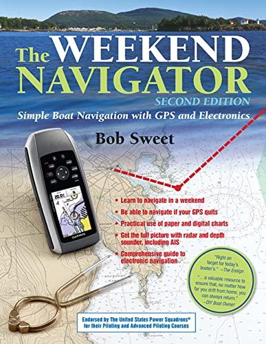
The WEEKEND NAVIGATOR
Simple Boat Navigation with GPS and Electronics
By Robert J. SweetThe McGraw-Hill Companies, Inc.
Copyright � 2012 Robert J. Sweet
All rights reserved.
ISBN: 978-0-07-175996-0All rights reserved.
Contents
| Preface and Acknowledgments to the Second Edition | |
| Part I—Introduction | |
| Chapter 1—About This Book | |
| Chapter 2—What Is Navigation? | |
| Chapter 3—Fundamentals of Waypoint Navigation | |
| Chapter 4—The Tools of Navigation | |
| Part II—Prevoyage Planning | |
| Chapter 5—Planning with GPS and Paper Charts | |
| Chapter 6—Planning with Digital Charts | |
| Chapter 7—Planning to Avoid Danger | |
| Part III—Navigating Underway | |
| Chapter 8—Underway with GPS and Paper Charts | |
| Chapter 9—Underway with Digital Charts | |
| Part IV—Double-Checking Your Navigation | |
| Chapter 10—Double-Checking Using Instruments | |
| Part V—Responding to Changing Conditions | |
| Chapter 12—What to Do If the GPS Quits | |
| Chapter 13—Planning as You Go with GPS | |
| Chapter 14—Tides, Winds, and Currents | |
| Part VI—Other Electronics | |
| Chapter 15—Navigating with Radar | |
| Chapter 16—Using Depth in Navigation | |
| Chapter 17—Using Radio in Navigation | |
| Chapter 18—Using an Electronic Compass | |
| Chapter 19—Automatic Identification System | |
| Chapter 20—Using an Autopilot in Navigation | |
| Part VII—Special Techniques | |
| Chapter 21—Navigating While Tacking into the Wind | |
| Chapter 22—Navigating Harbors and Channels with Electronics | |
| Chapter 23—Navigating under Adverse Conditions | |
| Chapter 24—A Last Word on Avoiding Danger | |
| Chapter 25—Advanced Topics in Radar | |
| Chapter 26—Other Instrumentation | |
| Chapter 27—Connecting It All Together | |
| Chapter 28—Electronic Navigation Tools and Rules—A Summary | |
| Chapter 29—Measuring Compass Deviation Using GPS | |
| Appendix 1—Using Digital Charts | |
| Appendix 2—GPS Display Overview—A Side-by-Side Comparison | |
| Appendix 3—Resources and References | |
| Index |
Excerpt
CHAPTER 1
About This Book
In the fog-shrouded past of a generation ago, navigation was still done as ithad been for centuries. A navigator would set forth on the wide waters armedwith his (or her) charts, dividers, course plotter, compass, eyes, and wits.Along unfamiliar coasts or through bad weather, he "felt" his way from port toport. Any charted navigation buoy or landmark was a valued reference; withbearings and distances from these, he could fix a point on a chart and say withconfidence, "I am there!"
But such confidence would be tested if those charted objects ever slipped fromview. In darkness or thick fog, the navigator could calculate only hisapproximate position. This calculation, this dead reckoning,worked when done well, but it wasn't dead on. Without precise fixes, thenavigator could only strain his eyes and ears to hear the reassuring peal of abell buoy or (heaven forbid) to see the foaming white surge of breakers overlurking rocks in the mist ahead.
But all that has changed.
Just prior to the close of the last millennium, GPS (the Global PositioningSystem) was born. Within a few years, GPS receivers had become popular andaffordable. Nowadays, if you have a hundred bucks and two AA batteries, you canbuy a handheld GPS and use it to plot your location anywhere on the Earth'ssurface. Just one glance at the GPS screen will tell you your precise location,your speed, your heading, and the direction and distance to your nextdestination. It will even give you the time of day.
GPS has made navigation easy. Within hours you can learn enough to get out onthe water. But those AA batteries won't last forever, and neither will your GPSreceiver, for that matter. Sure, the quantum leap in technology is impressive,but no one has yet invented electronics that won't eventually break down.Therefore, it's important that you also learn the techniques from a generationpast. You should know how to plot courses on a chart with dividers and parallelrules, steer them by compass, fix your position with visual bearings, and deadreckon when no bearings are possible. In short, you should know how to navigateby your wits.
The Weekend Navigator will teach you how to navigate in the digital age,but it will also teach you the time-honored techniques that never go out ofstyle and never lose their usefulness. You'll learn how to use a GPS receiver aswell as a handful of other modern electronic navigation tools, and you'll learnwithin a context that will strengthen your overall understanding of navigationconcepts. Despite all the new technologies, nautical charts remain the singlemost essential tool of the navigator, and unlocking their language stillrequires practice. So, it's important that we learn about navigation's pastbefore we can fully understand its future. After all, a straight line mayrepresent the shortest path between two points, but it isn't always the safest.
But here's the good news: with GPS on your side, you can safely do a lot more ofyour learning while you're boating, not before. Round up the recommendednavigation tools and spend a weekend with The Weekend Navigator, andyou'll be ready to start putting your navigation skills into practice.That's the GPS revolution.
Navigating This Book
This book can be considered both a "quick start" guide to navigation and areference guide. The early chapters will quickly get you up to speed and out onthe water. The later chapters will provide you with the advanced techniques andtools that only old salts know.
Part I gives you an overview. Using a sample cruise as an example,Chapters 2 and 3 help you see the important differences betweentraditional piloting and modern-day navigation. You'll learn the key concepts ofwaypoint navigation, and you'll be introduced to "The Three Steps ofNavigation." Chapter 4 introduces the necessary tools, both traditionaland digital.
Part II deals with prevoyage planning—the first of the three stepsin navigation. These chapters show you how to plot safe courses on both paperand digital charts and how to enter waypoints into a GPS.
By Part III, we've plotted courses and are ready to follow them acrossthe water. Navigating underway is the second step in navigation, and thesechapters teach you how to use a GPS, a computer, and a chartplotter from thehelm.
The third and final step in navigation is to confirm your electronics throughindependent means. Double-checking is the focus of Part IV. Thesechapters...
��ber diesen Titel� kann sich auf eine andere Ausgabe dieses Titels beziehen.
Weitere beliebte Ausgaben desselben Titels

Suchergebnisse f�r The Weekend Navigator, 2nd Edition: Simple Boat Navigation...

Beispielbild f�r diese ISBN
The Weekend Navigator: Simple Boat Navigation with GPS and Electronics
Verlag:
International Marine Publishing, 2011
ISBN 10: 0071759964
ISBN 13: 9780071759960
Gebraucht
Paperback
Anbieter: ThriftBooks-Dallas, Dallas, TX, USA
Verk�uferbewertung 5 von 5 Sternen
![]()
Paperback. Zustand: Good. No Jacket. Pages can have notes/highlighting. Spine may show signs of wear. ~ ThriftBooks: Read More, Spend Less. Artikel-Nr. G0071759964I3N00
Gebraucht kaufen
EUR 8,12
Versand gratis
Versand innerhalb von USA
Versand innerhalb von USA
Anzahl: 1 verf�gbar
Beispielbild f�r diese ISBN
The Weekend Navigator: Simple Boat Navigation with GPS and Electronics
Verlag:
International Marine Publishing, 2011
ISBN 10: 0071759964
ISBN 13: 9780071759960
Gebraucht
Paperback
Anbieter: ThriftBooks-Atlanta, AUSTELL, GA, USA
Verk�uferbewertung 5 von 5 Sternen
![]()
Paperback. Zustand: As New. No Jacket. Pages are clean and are not marred by notes or folds of any kind. ~ ThriftBooks: Read More, Spend Less. Artikel-Nr. G0071759964I2N00
Gebraucht kaufen
EUR 8,12
Versand gratis
Versand innerhalb von USA
Versand innerhalb von USA
Anzahl: 1 verf�gbar
Beispielbild f�r diese ISBN
The Weekend Navigator: Simple Boat Navigation with GPS and Electronics
Verlag:
International Marine Publishing, 2011
ISBN 10: 0071759964
ISBN 13: 9780071759960
Gebraucht
Paperback
Anbieter: ThriftBooks-Phoenix, Phoenix, AZ, USA
Verk�uferbewertung 5 von 5 Sternen
![]()
Paperback. Zustand: Good. No Jacket. Pages can have notes/highlighting. Spine may show signs of wear. ~ ThriftBooks: Read More, Spend Less. Artikel-Nr. G0071759964I3N00
Gebraucht kaufen
EUR 8,12
Versand gratis
Versand innerhalb von USA
Versand innerhalb von USA
Anzahl: 1 verf�gbar
Beispielbild f�r diese ISBN
The Weekend Navigator: Simple Boat Navigation with GPS and Electronics
Verlag:
International Marine Publishing, 2011
ISBN 10: 0071759964
ISBN 13: 9780071759960
Gebraucht
Paperback
Anbieter: ThriftBooks-Reno, Reno, NV, USA
Verk�uferbewertung 5 von 5 Sternen
![]()
Paperback. Zustand: Good. No Jacket. Pages can have notes/highlighting. Spine may show signs of wear. ~ ThriftBooks: Read More, Spend Less. Artikel-Nr. G0071759964I3N00
Gebraucht kaufen
EUR 8,12
Versand gratis
Versand innerhalb von USA
Versand innerhalb von USA
Anzahl: 1 verf�gbar
Beispielbild f�r diese ISBN
The Weekend Navigator, 2nd Edition
Verlag:
International Marine/Ragged Mountain Press, 2011
ISBN 10: 0071759964
ISBN 13: 9780071759960
Gebraucht
Softcover
Anbieter: Wonder Book, Frederick, MD, USA
Verk�uferbewertung 5 von 5 Sternen
![]()
Zustand: Very Good. Very Good condition. 2nd edition. A copy that may have a few cosmetic defects. May also contain light spine creasing or a few markings such as an owner's name, short gifter's inscription or light stamp. Artikel-Nr. X08I-00910
Gebraucht kaufen
EUR 27,66
Versand gratis
Versand innerhalb von USA
Versand innerhalb von USA
Anzahl: 1 verf�gbar
Beispielbild f�r diese ISBN
The Weekend Navigator
Anbieter: Majestic Books, Hounslow, Vereinigtes K�nigreich
Verk�uferbewertung 4 von 5 Sternen
![]()
Zustand: New. pp. viii + 280 Illus. (Col.), Map (Col.). Artikel-Nr. 4304860
Neu kaufen
EUR 42,32
EUR 7,54 Versand
Versand von Vereinigtes K�nigreich nach USA
Versand von Vereinigtes K�nigreich nach USA
Anzahl: 1 verf�gbar
Beispielbild f�r diese ISBN
THE WEEKEND NAVIGATOR
Verlag:
International Marine/Ragged Mountain Press, 2011
ISBN 10: 0071759964
ISBN 13: 9780071759960
Neu
Softcover
Anbieter: Romtrade Corp., STERLING HEIGHTS, MI, USA
Verk�uferbewertung 5 von 5 Sternen
![]()
Zustand: New. This is a Brand-new US Edition. This Item may be shipped from US or any other country as we have multiple locations worldwide. Artikel-Nr. ABBB-190218
Beispielbild f�r diese ISBN
The Weekend Navigator: Simple Boat Navigation With Gps and Electronics
Anbieter: Revaluation Books, Exeter, Vereinigtes K�nigreich
Verk�uferbewertung 5 von 5 Sternen
![]()
Paperback. Zustand: Brand New. 2nd edition. 288 pages. 10.70x8.50x0.50 inches. In Stock. Artikel-Nr. x-0071759964
Neu kaufen
EUR 48,71
EUR 14,50 Versand
Versand von Vereinigtes K�nigreich nach USA
Versand von Vereinigtes K�nigreich nach USA
Anzahl: 2 verf�gbar