Verwandte Artikel zu 2014 Collins Map of Scotland
Zu dieser ISBN ist aktuell kein Angebot verf�gbar.
Alle Exemplare der Ausgabe mit dieser ISBN anzeigen:
Rese�a del editor:
Biograf�a del autor:
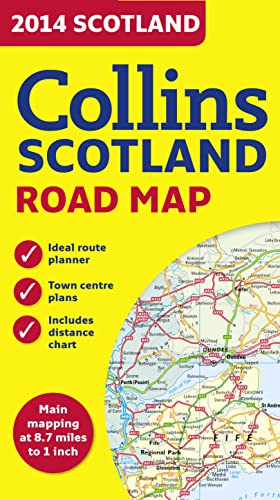
Full colour map of Scotland at 8.7 miles to 1 inch (1:550,000) with clear, detailed road network and administrative areas shown in colour. The map covers the whole of Scotland and part of Northern England conveniently on one side, and is ideal for reference or route planning.
The map shows the road network in detail for easy route planning. It is ideal for business users also, with its political colouring of local council areas.
MAIN FEATURES
� Fully updated for 2014.
� Administrative areas shown in colour.
� Clear, detailed road network and road distances.
� Town and city names, rivers, railway lines and canals are clearly shown.
� 7 city/town centre street plans showing places of interest.
� Index to place names.
� Mileage chart.
� Car ferry routes.
� Key in English, French and German.
Explore the world through accurate and up-to-date mapping.
��ber diesen Titel� kann sich auf eine andere Ausgabe dieses Titels beziehen.
- VerlagCollins
- Erscheinungsdatum2013
- ISBN 10 0007497148
- ISBN 13 9780007497140
- EinbandMapa
- Bewertung
Beste Suchergebnisse beim ZVAB

Beispielbild f�r diese ISBN
2014 Collins Scotland Road Map
Anbieter:
Bewertung
Buchbeschreibung map. Zustand: Good. Artikel-Nr. mon0003106328
Weitere Informationen zu diesem Verk�ufer | Verk�ufer kontaktieren
Gebraucht kaufen
EUR 1,92
W�hrung umrechnen