
Verwandte Artikel zu The Great Arc: The Dramatic Tale of How India Was Mapped...
Inhaltsangabe
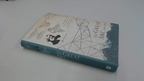
A vivid description of one of the most ambitious scientific projects undertaken in the 19th century, and the men who undertook the measurement of the Himalayas and the mapping of the Indian subcontinent: William Lambton and George Everest.
The graphic story of the measurement of a meridian, or longitudinal, arc extending from the tip of the Indian subcontinent to the mountains of the Himalayas.
Much the longest such measurement hitherto made, it posed horrendous technical difficulties, made impossible physical demands on the survey parties (jungle, tigers, mountains etc.), and took over 50 years. But the scientific results were commensurate, including the discovery of the world’s highest peaks and a new calculation of the curvature of the earth’s surface.
The Indian Mutiny of 1857 triggered a massive construction of roads, railways, telegraph lines and canals throughout India: all depended heavily on the accuracy of the maps which the Great Arc had made possible.
Die Inhaltsangabe kann sich auf eine andere Ausgabe dieses Titels beziehen.
Über die Autorin bzw. den Autor
John Keay is the author of four acclaimed histories: 'The Honourable Company', 'Last Post', about the imperial disengagement of the Far East; the two-volume 'Explorers of the Western Himalayas' and 'India: A History'. His books on India include 'India Discovered', 'Into India' and 'The Great Arc: The Dramatic Tale of How India was Mapped and Everest was Named'. John Keay is married with four children, lives in Scotland and is co-editor with Julia Keay of the 'Collins Encyclopaedia of Scotland'.
„Über diesen Titel“ kann sich auf eine andere Ausgabe dieses Titels beziehen.
Suchergebnisse für The Great Arc: The Dramatic Tale of How India Was Mapped...

Beispielbild für diese ISBN
The Great Arc: The Dramatic Tale of How India was Mapped and Everest was Named
Anbieter: AwesomeBooks, Wallingford, Vereinigtes Königreich
Verkäuferbewertung 5 von 5 Sternen

Hardcover. Zustand: Very Good. The Great Arc: The Dramatic Tale of How India was Mapped and Everest was Named This book is in very good condition and will be shipped within 24 hours of ordering. The cover may have some limited signs of wear but the pages are clean, intact and the spine remains undamaged. This book has clearly been well maintained and looked after thus far. Money back guarantee if you are not satisfied. See all our books here, order more than 1 book and get discounted shipping. Artikel-Nr. 7719-9780002570626
Gebraucht kaufen
EUR 3,56
EUR 4,80 Versand
Versand von Vereinigtes Königreich nach USA
Versand von Vereinigtes Königreich nach USA
Anzahl: 2 verfügbar
Foto des Verkäufers
The Great Arc: The Dramatic Tale of How India was Mapped and Everest was Named
Anbieter: WeBuyBooks, Rossendale, LANCS, Vereinigtes Königreich
Verkäuferbewertung 5 von 5 Sternen
hardcover. Zustand: Good. Most items will be dispatched the same or the next working day. A copy that has been read but remains in clean condition. All of the pages are intact and the cover is intact and the spine may show signs of wear. The book may have minor markings which are not specifically mentioned. Artikel-Nr. rev2670507204
Gebraucht kaufen
EUR 1,47
EUR 7,45 Versand
Versand von Vereinigtes Königreich nach USA
Versand von Vereinigtes Königreich nach USA
Anzahl: 4 verfügbar
Beispielbild für diese ISBN
The Great Arc: the dramatic tale of how India was mapped and Everest was named
Verlag:
HARPERCOLLINS PUBLISHERS LTD, 2000
ISBN 10: 0002570629
ISBN 13: 9780002570626
Gebraucht
Hardcover
Anbieter: ThriftBooks-Atlanta, AUSTELL, GA, USA
Verkäuferbewertung 5 von 5 Sternen
Hardcover. Zustand: Very Good. No Jacket. May have limited writing in cover pages. Pages are unmarked. ~ ThriftBooks: Read More, Spend Less. Artikel-Nr. G0002570629I4N00
Gebraucht kaufen
EUR 9,85
Versand gratis
Versand innerhalb von USA
Versand innerhalb von USA
Anzahl: 1 verfügbar
Beispielbild für diese ISBN
The Great Arc: the dramatic tale of how India was mapped and Everest was named
Verlag:
HARPERCOLLINS PUBLISHERS LTD, 2000
ISBN 10: 0002570629
ISBN 13: 9780002570626
Gebraucht
Hardcover
Anbieter: ThriftBooks-Dallas, Dallas, TX, USA
Verkäuferbewertung 5 von 5 Sternen
Hardcover. Zustand: Very Good. No Jacket. May have limited writing in cover pages. Pages are unmarked. ~ ThriftBooks: Read More, Spend Less. Artikel-Nr. G0002570629I4N00
Gebraucht kaufen
EUR 9,85
Versand gratis
Versand innerhalb von USA
Versand innerhalb von USA
Anzahl: 1 verfügbar
Beispielbild für diese ISBN
The Great Arc: The Dramatic Tale of How India was Mapped and Everest was Named
Verlag:
HARPERCOLLINS PUBLISHERS LTD, 2000
ISBN 10: 0002570629
ISBN 13: 9780002570626
Gebraucht
Hardcover
Anbieter: WorldofBooks, Goring-By-Sea, WS, Vereinigtes Königreich
Verkäuferbewertung 5 von 5 Sternen
Hardback. Zustand: Very Good. The book has been read, but is in excellent condition. Pages are intact and not marred by notes or highlighting. The spine remains undamaged. Artikel-Nr. GOR001194939
Gebraucht kaufen
EUR 4,63
EUR 6,52 Versand
Versand von Vereinigtes Königreich nach USA
Versand von Vereinigtes Königreich nach USA
Anzahl: 8 verfügbar
Beispielbild für diese ISBN
The Great Arc: The Dramatic Tale of How India was Mapped and Everest was Named
Verlag:
HARPERCOLLINS PUBLISHERS LTD, 2000
ISBN 10: 0002570629
ISBN 13: 9780002570626
Gebraucht
Hardcover
Anbieter: WorldofBooks, Goring-By-Sea, WS, Vereinigtes Königreich
Verkäuferbewertung 5 von 5 Sternen
Hardback. Zustand: Fair. A readable copy of the book which may include some defects such as highlighting and notes. Cover and pages may be creased and show discolouration. Artikel-Nr. GOR004356382
Gebraucht kaufen
EUR 4,63
EUR 6,52 Versand
Versand von Vereinigtes Königreich nach USA
Versand von Vereinigtes Königreich nach USA
Anzahl: 1 verfügbar
Beispielbild für diese ISBN
The Great Arc: The Dramatic Tale of How India was Mapped and Everest was Named
Verlag:
HarperCollins Publishers, United Kingdom, London, 2000
ISBN 10: 0002570629
ISBN 13: 9780002570626
Gebraucht
Paperback
Anbieter: WorldofBooks, Goring-By-Sea, WS, Vereinigtes Königreich
Verkäuferbewertung 5 von 5 Sternen
Paperback. Zustand: Good. A vivid description of one of the most ambitious scientific projects undertaken in the 19th century, and the men who undertook the measurement of the Himalayas and the mapping of the Indian subcontinent: William Lambton and George Everest. The graphic story of the measurement of a meridian, or longitudinal, arc extending from the tip of the Indian subcontinent to the mountains of the Himalayas. Much the longest such measurement hitherto made, it posed horrendous technical difficulties, made impossible physical demands on the survey parties (jungle, tigers, mountains etc.), and took over 50 years. But the scientific results were commensurate, including the discovery of the worlds highest peaks and a new calculation of the curvature of the earths surface. The Indian Mutiny of 1857 triggered a massive construction of roads, railways, telegraph lines and canals throughout India: all depended heavily on the accuracy of the maps which the Great Arc had made possible. The book has been read but remains in clean condition. All pages are intact and the cover is intact. Some minor wear to the spine. Artikel-Nr. GOR000963136
Gebraucht kaufen
EUR 4,63
EUR 6,52 Versand
Versand von Vereinigtes Königreich nach USA
Versand von Vereinigtes Königreich nach USA
Anzahl: 2 verfügbar
Beispielbild für diese ISBN
The Great Arc : The Dramatic Tale of How India Was Mapped and Everest Was Named
Verlag:
HarperCollins Publishers Limited, 2000
ISBN 10: 0002570629
ISBN 13: 9780002570626
Gebraucht
Hardcover
Anbieter: Better World Books Ltd, Dunfermline, Vereinigtes Königreich
Verkäuferbewertung 5 von 5 Sternen
Zustand: Good. Pages intact with minimal writing/highlighting. The binding may be loose and creased. Dust jackets/supplements are not included. Stock photo provided. Product includes identifying sticker. Better World Books: Buy Books. Do Good. Artikel-Nr. GRP105356297
Gebraucht kaufen
EUR 5,61
EUR 5,82 Versand
Versand von Vereinigtes Königreich nach USA
Versand von Vereinigtes Königreich nach USA
Anzahl: 2 verfügbar
Beispielbild für diese ISBN
The Great Arc : The Dramatic Tale of How India Was Mapped and Everest Was Named
Verlag:
HarperCollins Publishers Limited, 2000
ISBN 10: 0002570629
ISBN 13: 9780002570626
Gebraucht
Hardcover
Anbieter: Better World Books Ltd, Dunfermline, Vereinigtes Königreich
Verkäuferbewertung 5 von 5 Sternen
Zustand: Very Good. Former library copy. Pages intact with possible writing/highlighting. Binding strong with minor wear. Dust jackets/supplements may not be included. Includes library markings. Stock photo provided. Product includes identifying sticker. Better World Books: Buy Books. Do Good. Artikel-Nr. 39223068-6
Gebraucht kaufen
EUR 5,61
EUR 5,82 Versand
Versand von Vereinigtes Königreich nach USA
Versand von Vereinigtes Königreich nach USA
Anzahl: 1 verfügbar
Beispielbild für diese ISBN
The Great Arc : The Dramatic Tale of How India Was Mapped and Everest Was Named
Verlag:
HarperCollins Publishers Limited, 2000
ISBN 10: 0002570629
ISBN 13: 9780002570626
Gebraucht
Hardcover
Anbieter: Better World Books Ltd, Dunfermline, Vereinigtes Königreich
Verkäuferbewertung 5 von 5 Sternen
Zustand: Good. Former library copy. Pages intact with minimal writing/highlighting. The binding may be loose and creased. Dust jackets/supplements are not included. Includes library markings. Stock photo provided. Product includes identifying sticker. Better World Books: Buy Books. Do Good. Artikel-Nr. GRP14530981
Gebraucht kaufen
EUR 5,61
EUR 5,82 Versand
Versand von Vereinigtes Königreich nach USA
Versand von Vereinigtes Königreich nach USA
Anzahl: 3 verfügbar