
Gesamtpreis (1 Artikel Artikel):
Versandziel:

batam (7 Ergebnisse)
Produktart
- Alle Product Types
- Bücher (6)
- Magazine & Zeitschriften
- Comics
- Noten
- Kunst, Grafik & Poster
- Fotografien
- Karten (1)
- Manuskripte & Papierantiquitäten
Zustand
Einband
Weitere Eigenschaften
- Erstausgabe
- Signiert
- Schutzumschlag
- Angebotsfoto (6)
Gratisversand
- Versand nach USA gratis
Land des Verkäufers
Verkäuferbewertung
-
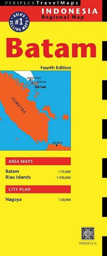
Batam (Periplus Travel Maps)
Verlag: Periplus Editions (Hong Kong) Lt, 2003
ISBN 10: 0794600247ISBN 13: 9780794600242
Buch
Zustand: Good. Most items will be dispatched the same or the next working day. Minor shelf wear.
-

Challenges to the Churches in a Changing World. Texts from the 4th International UEM Consultation on Justice, Peace and the Integrity of Creation - Batam / Indonesia, February 2008.
Verlag: Foedus-Verlag, 2008
ISBN 10: 3938180110ISBN 13: 9783938180112
Anbieter: books4less (Versandantiquariat Petra Gros GmbH & Co. KG), Welling, Deutschland
Bewertung:

Buch
Broschiert. Zustand: Gut. 204 Seiten; Der Erhaltungszustand des hier angebotenen Werks ist trotz seiner Bibliotheksnutzung sauber. Es befindet sich neben dem Rückenschild lediglich ein Bibliotheksstempel im Buch; ordnungsgemäß entwidmet. In ENGLISCHER Sprache. Einbandkanten sind leicht bestoßen. Sprache: Englisch Gewicht in Gramm: 300.
-

Paperback. Paperback; 204 Seiten -/- Zustand: sehr gut ; Besitzername vorne im Buch 9783938180112 -** Kein Auslandsversand in die Mitgliedsstaaten der EU möglich **.
-

Couverture rigide. Zustand: bon. RO90005092: 1931. In-12. Cartonnage d'éditeurs. Etat d'usage, Couv. défraîchie, Dos frotté, Intérieur frais. 248 pages. Traces de mouillure sur le premier plat. . . . Classification Dewey : 830-Littératures des langues germaniques.
-

HIV als transnationales Problem : Die HIV-Epidemie auf Batam, Indonesien
Verlag: GRIN Verlag, 2011
ISBN 10: 3640945492ISBN 13: 9783640945498
Buch
Taschenbuch. Zustand: Neu. Druck auf Anfrage Neuware - Printed after ordering - Diplomarbeit aus dem Jahr 2008 im Fachbereich Südasienkunde, Südostasienkunde, Note: 1,3, Rheinische Friedrich-Wilhelms-Universität Bonn (Institut für Orient- und Asienwissenschaften), Veranstaltung: Regionalwissenschaften Südostasien, Sprache: Deutsch, Abstract: The island of Batam, which belongs to the Indonesian Province Riau Kepulauan, has undergone an extreme transformation in the past fifty years. In the 1950s it was still a sparsely populated fishing community, whereas today it is - through continuous migration - a densely populated multi-ethnic and transnational industrial location. This is mainly due to its membership of the SIJORI Growth Triangle: an arrangement between Singapore, Johor (in Malaysia), and Riau Islands (in Indonesia). This growth has produced a new set of social problems for the island, in particular, the spread of HIV/AIDS. In my thesis I will analyse the HIV/AIDS problem in Batam with a focus on the transnational situation of the island and I will point out how the HI-virus is spreading from Batam to other parts of Indonesia and surrounding countries. This thesis deals with the transnational and economic development of Batam; the mass migration to the island; its immense sex industry; the HIV-transmission, and in particular, how the virus is transmitting itself over the boundaries of Batam. In conclusion I will describe the governmental policies of Indonesia and Singapore regarding HIV, and also the approach of different non-governmental organisations. In both cases I consider closely the question of how they handle the transnational situation of the island.
-

"Plan du Port de Rio . en l'Isle de Bintam" - Bintan Island Batam Malaysia Rio sea map Karte Mannevillette Neptune Oriental
Verlag: Paris, Demonville, 1775
Anbieter: Antiquariat Steffen Völkel GmbH, Seubersdorf, Deutschland
Bewertung:
Karte
seltene original Kupferstich See-Karte nach Mannevillette aus dem See-Atlas "Neptune Oriental" von 1775 - Blattmasse: ca. 38 x 53 cm - gut erhalten. | rare original 18th century french nautical chart after Mannevillette out of the sea atlas "Neptune Oriental" from 1775 - size of sheet: circa. 15 x 20.9 inches - good condition. | Dies ist ein Original! - Kein Nachdruck! - Keine Kopie! -- This is an original! - No copy! - No reprint! Sprache: Deutsch Gewicht in Gramm: 1500.
-
Antique map-INDONESIA-BINTANG-BATAM-SOUTH CHINA SEA CHART-Reed-Stafford-1869
Erscheinungsdatum: 1869
Anbieter: Pictura Prints, Art & Books, Overasselt, Niederlande
Bewertung:
Engraving on wove paper. on paper. Size in cm: The overall size is ca. 68.8 x 102.3 cm. The image size is ca. 64.7 x 99 cm. Size in inch: The overall size is ca. 27.1 x 40.3 inch. The image size is ca. 25.5 x 39 inch.Antique map, titled: ''China Sea - Rhios Strait [â¦].'' - Detailed chart of the strait between Pulau Bintang and Pulau Batam, South China Sea, Indonesia. Other islands shown in the map are Rempang, Galang and Galang-Baru. The map area stretches south as far as Pulau Mesanak (here Missana Island). With highly detailed depth soundings. Places along the coast are named, as are geographical features inland. Published by the Admiralty in 1869 based on Reed and Tizard's survey of 1865-1866. These type of charts are scarse as they were actually used at sea for navigation.Artists and Engravers: Made by 'H. Stafford' after 'H.W. Reed'.Condition: Good, given age. The margin edges with several small tears and creases. Some scattered small stains. A few faint stains in the image area. General age-related toning and/or occasional minor defects from handling. Please study scan carefully.Keywords: ANTIQUE MAP-INDONESIA-BINTANG-BATAM-SOUTH CHINA SEA CHART-REED-STAFFORD(PCO) ZH-404.
