
Gesamtpreis (1 Artikel Artikel):
Versandziel:

9781782570547 - 50 Miles around Bristol A-Z Road Map von A-Z Maps (6 Ergebnisse)
Direkt zu den wichtigsten Suchergebnissen
Produktart
- Alle Produktarten
- Bücher (6)
- Magazine & Zeitschriften
- Comics
- Noten
- Kunst, Grafik & Poster
- Fotografien
- Karten
-
Manuskripte &
Papierantiquitäten
Zustand
Einband
- alle Einbände
- Hardcover
- Softcover (3)
Weitere Eigenschaften
- Erstausgabe
- Signiert
- Schutzumschlag
- Angebotsfoto (2)
Land des Verkäufers
Verkäuferbewertung
-
![Beispielbild für 50 MILES AROUND BRISTOL A-Z ROAD MAP [New 24th edition] zum Verkauf von WorldofBooks](https://pictures.abebooks.com/isbn/9781782570547-de-300.jpg)
50 MILES AROUND BRISTOL A-Z ROAD MAP [New 24th edition]
Verlag: HarperCollins Publishers, United Kingdom, 2018
ISBN 10: 1782570543ISBN 13: 9781782570547
Buch
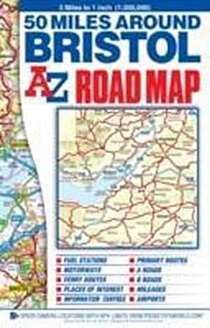
Paperback. Zustand: Very Good. This A-Z 50 Miles around Bristol map is a full colour, single sided, fold-out road map featuring continuous mapping extending to include Worcester and Stratford-upon-Avon to the north, Witney and Andover to the east, Bournemouth and Lyme Regis to the south and Minehead and Bridgend to the west. Published at a clear 3 miles to 1 inch the following features are shown on the road mapping: Motorways open with full junction detail, motorways under construction and proposed, service areas, primary routes and destinations, A & B roads, selected minor roads, gradients 1:5 and steeper, tolls, mileages, national and county boundaries, spot heights and hill shading. Selected safety camera locations with maximum speed limits. Selected fuel stations. A wide range of ancillary and tourist information. Brecon Beacons, New Forest and Exmoor National Park boundaries. The index to cities, towns, villages, hamlets and locations is adjacent to the map. The book has been read, but is in excellent condition. Pages are intact and not marred by notes or highlighting. The spine remains undamaged.
-
50 MILES AROUND BRISTOL A-Z ROAD MAP [New 24th edition]
Verlag: HarperCollins Publishers, United Kingdom, 2018
ISBN 10: 1782570543ISBN 13: 9781782570547
Buch
Paperback. Zustand: Good. This A-Z 50 Miles around Bristol map is a full colour, single sided, fold-out road map featuring continuous mapping extending to include Worcester and Stratford-upon-Avon to the north, Witney and Andover to the east, Bournemouth and Lyme Regis to the south and Minehead and Bridgend to the west. Published at a clear 3 miles to 1 inch the following features are shown on the road mapping: Motorways open with full junction detail, motorways under construction and proposed, service areas, primary routes and destinations, A & B roads, selected minor roads, gradients 1:5 and steeper, tolls, mileages, national and county boundaries, spot heights and hill shading. Selected safety camera locations with maximum speed limits. Selected fuel stations. A wide range of ancillary and tourist information. Brecon Beacons, New Forest and Exmoor National Park boundaries. The index to cities, towns, villages, hamlets and locations is adjacent to the map. The book has been read but remains in clean condition. All pages are intact and the cover is intact. Some minor wear to the spine.
-
50 Miles Around Bristol A-Z Road Map
Verlag: HarperCollins Publishers 2018-01-03, London, 2018
ISBN 10: 1782570543ISBN 13: 9781782570547
Buch
sheet map (folded). Zustand: New. Language: ENG.
-
50 Miles Around Bristol Road Map
Verlag: Geographers' A-Z Map Co Ltd, 2014
ISBN 10: 1782570543ISBN 13: 9781782570547
Buch
Map. Zustand: New. BRAND NEW ** SUPER FAST SHIPPING FROM UK WAREHOUSE ** 30 DAY MONEY BACK GUARANTEE.
-
50 Miles Around Bristol Road Map
Verlag: GEOGRAPHERS Dez 2014, 2014
ISBN 10: 1782570543ISBN 13: 9781782570547
Buch
Taschenbuch. Zustand: Neu. Neuware Englisch.
-
Geographers A-Z Map Co. Limited : 50 Miles Around Bristol Road M
Verlag: Geographers\' A-Z Map Co Ltd, 2014
ISBN 10: 1782570543ISBN 13: 9781782570547
Buch
Zustand: New. This A-Z 50 Miles around Bristol map is a full colour, single sided, fold-out road map featuring continuous mapping extending to include Worcester and Stratford-upon-Avon to the north, Witney and Andover to the east, Bournemouth and Lyme Regis to the south .