Gesamtpreis (1 Artikel Artikel):
Versandziel:

F E YOUNGHUSBAND (2 Ergebnisse)
Direkt zu den wichtigsten Suchergebnissen
Produktart
- Alle Produktarten
- Bücher (2)
- Magazine & Zeitschriften
- Comics
- Noten
- Kunst, Grafik & Poster
- Fotografien
- Karten
-
Manuskripte &
Papierantiquitäten
Zustand
- Alle
- Neu
- Antiquarisch/Gebraucht
Einband
- alle Einbände
- Hardcover
- Softcover
Weitere Eigenschaften
- Erstausgabe (1)
- Signiert
- Schutzumschlag
- Angebotsfoto
Land des Verkäufers
Verkäuferbewertung
-
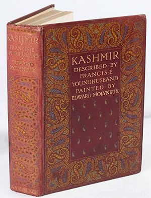
Kashmir
Verlag: Adam and Charles Black., London., 1909
Anbieter: Asia Bookroom ANZAAB/ILAB, Canberra, ACT, Australien
Bewertung:

Erstausgabe
First Edition. Folding map in colour, 70 colour plates with captioned tissue guards, dark red cloth with a design printed in blue, orange and yellow and blocked in gilt on the front cover and spine. xv+ 283pp and 4 pages of adverts for A&C Black's 20 shilling, 10 shilling and miscellaneous series. 22 x 15.9cm. Covers very slightly rubbed, spine mildly sunned, head and tail of spine worn, prior owner details on the front free endpaper. A little repair neat repair work upper section of upper joint. Preliminaries, finals and edges spotted but text block generally clean, the illustrations are bright and clean. A good copy of the first edition. Inman 49. 'The present book will deal, not with the whole Kashmir State , which includes many outlying provinces but with Kashmir Proper, with the world re-nowned valley of Kashmir, a saucer shaped vale with a length of 84 miles , a breadth of 20 to 25 miles and a mean height of 5600 feet above sea-level set in the very heart of the Himalaya.'.
-
Proceedings of the Royal Geographical Society of London, Volume V - XIV, 1883 through 1892,10 volumes of the Journal of the RGS
Verlag: Edward Stanford, London, 1883
Anbieter: Antipodean Books, Maps & Prints, ABAA, Garrison, NY, USA
Verbandsmitglied: ABAA ANZAAB ESA ILAB
Bewertung:

Hardcover. Zustand: Very good overall. Royal Geographical Society Journal for 1883 through 1892, the complete years, bound with the original blue wrappers included, in three quarter black calf with marbled boards & all edges stippled. Ex-lib, with Andover Theological Seminary Library bookplate and stamp; spine ends of some volumes slt rubbed. Includes many articles and folding maps, including the following from each year: Volume V, 1883: China, in some of its Physical and Social Aspects, by E. Colborne Baber; Visits to the Eastern and North-Eastern Coasts of New Guinea, by Wilfred Powell. All folding maps present. Volume VI, 1884: Recent Explorations in the Southern Alps of New Zealand, by the Rev. W. S. Green; Three Months' Exploration in the Tenimber Islands, or Timor Laut, by H. O. Forbes; Travel and Ascents in the Himalaya, by W. W. Graham; Mr. C. Winnecke's Last Explorations in the Northern Territory, South Australia. All folding maps present. Volume VII, 1885: Discovery of the True Source of the Mississippi, by Captain Willard Glazier; Four Years' Journeyings through Great Tibet, by one of the Trans-Himalayan Explorers of the Survey of India by General J. T. Walker; The Kilima-njaro Expedition, by H. H. Johnston; The Ascent of Mount Roraima, by Everard im Thurn. All folding maps present. Volume VIII, 1886: LACKS map at p416, Physical map of Brazil; sketch map of South-western China. Exploration Survey for a Railway Connection between India, Siam, and China, by Holt S. Hallett; Recent Journeys in Korea, by W. R. Charles; Burma: the Country and People, by J. Annan Bryce; Crusides in Melanesia, Micronesia, and Western Polynesia, in 1882, 1883, and 1884, and Visits to New Guinea and the Louisiades in 1884 and 1885, by Captain Cyprian Bridge. With 10 other folding maps. Volume IX, 1887: The Islands of the New Britain Group, by H. H. Romilly; Explorations in South-eastern New Guinea, by Rev. J. Chalmers; A Journey in Manchuria, by H. E. M. James; Discovery of Two New Rivers in British New Guinea, by Theodore F. Bevan. All folding maps present. Volume X, 1888: Explorations in British North Borneo, 1883-87, by D. D. Daly; On the Ruby Mines near Mogok, Burma, by Robert Gordon; The Kaap Gold-Fields of the Transvaal, by Fred. Jeppe; A Journey across Central Asia, from Manchuria and Peking to Kashmir, over the Mustagh Pass, by Lieut. F. E. Younghusband; Hudson's Bay and Hudson's Strait as a Navigable Channel, by Commodore A. H. Markham. All folding maps present. Volume XI, 1889: Letter from Mr. H. M. Stanley, on his Journey from Yambuya Camp to the Albert Nyanza; Journey Across the Inland Ice of Greenland from East to West, by Dr. Fridtjof Nansen; New Guinea: Narrative of an Exploring Expedition to the Louisiade and D'Entrecasteaux Islands, by Basil Thomson. All folding maps present. Volume XII, 1890: The Great Central Asian Trade Route from Peking to Kashgaria, by Colonel Mark S. Bell; Journey to the Summit of the Owen Stanley Range, New Guinea, by Sir William Macgregor; Ascent to the Summit of Kilima-njaro, by Dr. Hans Meyer. All folding maps present. Volume XIII, 1891: Explorations in Alaska and North-west British Columbia, by H. W. Seton-Karr; The Meteorological Results of the 'Challenger' Expedition in Relation to Physical Geography, by Alexander Buchan; From Hai-phong in Tong-king to Canton, overland, by A. R. Agassiz; Two Journeys to Ta-tsien-lu on the Eastern Borders of Tibet, by A. E. Pratt; Central Australia by Charles Chewings. All folding maps present. Volume XIV, 1892: LACKS the folding map of Persia, p140. A Journey Through North Korea to the Ch'ang-Pai Shan, by Charles Campbell; Journeys is the Pamirs and Adjacent Countries, by Captain F. E. Younghusband; Discovery of the Galapagos Islands, by Clements R. Markham; Columbus, and the Fourth Centenary of his Discovery, by Clements R. Markham; With 10 other folding maps. Scarce.