Manchester Big A-Z Street Atlas - Softcover
Zu dieser ISBN ist aktuell kein Angebot verf�gbar.
Alle Exemplare der Ausgabe mit dieser ISBN anzeigen:
Rese�a del editor:
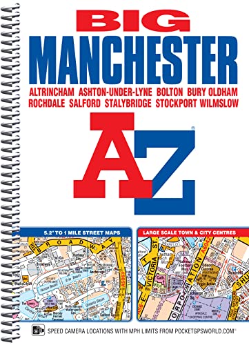
This spiral bound Big map of Manchester includes coverage of: Manchester, Altrincham, Ashton-under-Lyne, Bolton, Bury, Oldham, Rochdale, Salford and Stockport. The atlas includes 162 pages of continuous street mapping at a 'Big' 5.2 inches to 1 mile (8.2 cm to 1 km) extending to include coverage of: Cheadle, Heywood, Hyde, Irlam, Manchester Airport, Poynton, Prestwich, Radcliffe, Ramsbottom, Stalybridge, Swinton, Urmston and Wilmslow. There are also large scale city and town centre maps of Manchester, Altrincham, Ashton-under-Lyne, Bolton, Bury, Oldham, Rochdale and Stockport and a postcode map. Postcode districts, one-way streets, safety camera locations with speed limits and National Park boundaries are also featured on the mapping. The index section lists streets; selected flats, walkways and places of interest; place and area names; National Rail and Metrolink stations. There is a separate list of hospitals, hospices and NHS Walk-in Centres covered by the atlas. An easy to follow map of the Manchester Metrolink is featured on the back cover.
��ber diesen Titel� kann sich auf eine andere Ausgabe dieses Titels beziehen.
- VerlagGeographers’ A-Z Map Co Ltd
- Erscheinungsdatum2016
- ISBN 10 1782571280
- ISBN 13 9781782571285
- EinbandEncuadernaci�n en espiral
- Anzahl der Seiten272
(Keine Angebote verf�gbar)
Buch Finden: Kaufgesuch aufgebenSie kennen Autor und Titel des Buches und finden es trotzdem nicht auf ZVAB? Dann geben Sie einen Suchauftrag auf und wir informieren Sie automatisch, sobald das Buch verf�gbar ist!
Kaufgesuch aufgeben