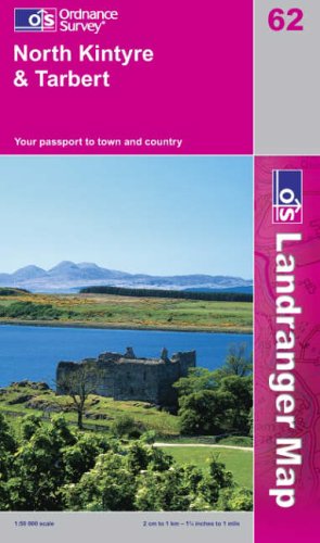
North Kintyre and Tarbert: Sheet 62 (Landranger Maps)
Zu dieser ISBN ist aktuell kein Angebot verf�gbar.
Alle Exemplare der Ausgabe mit dieser ISBN anzeigen:
Rese�a del editor:
This map is part of the Landranger (Pink) series and is designed for people who really want to get to know an area. It includes the following information: tourist information, camping and caravan sites, picnic areas and viewpoints, selected places of interest and rights of way information for England and Wales. Each map in the series covers an area of 40 km by 40 km (25 miles by 25 miles) and like other Ordnance Survey maps, National Grid squares are provided so that any feature can be given a unique reference number. Perfect for planning ahead and local excursions, these maps are full of useful information that will help you really get to know an area.
��ber diesen Titel� kann sich auf eine andere Ausgabe dieses Titels beziehen.
- VerlagOrdnance Survey
- Erscheinungsdatum2002
- ISBN 10 031922662X
- ISBN 13 9780319226629
- EinbandMapa
Gebraucht kaufen
Zustand: BefriedigendThe book has been read but remains... Mehr zu diesem Angebot erfahren

EUR 0,93
Versand:
EUR 5,59
Von Vereinigtes K�nigreich nach USA
Beste Suchergebnisse beim ZVAB
Beispielbild f�r diese ISBN
North Kintyre and Tarbert: Sheet 62 (Landranger Maps)
Anbieter:
Bewertung
Buchbeschreibung Paperback. Zustand: Good. The book has been read but remains in clean condition. All pages are intact and the cover is intact. Some minor wear to the spine. Artikel-Nr. GOR003649827
Weitere Informationen zu diesem Verk�ufer | Verk�ufer kontaktieren
Gebraucht kaufen
EUR 0,93
W�hrung umrechnen
Foto des Verk�ufers
North Kintyre and Tarbert: Sheet 62 (Landranger Maps)
Anbieter:
Bewertung
Buchbeschreibung Zustand: Good. Most items will be dispatched the same or the next working day. Artikel-Nr. wbs1895595291
Weitere Informationen zu diesem Verk�ufer | Verk�ufer kontaktieren
Gebraucht kaufen
EUR 0,93
W�hrung umrechnen
Beispielbild f�r diese ISBN
North Kintyre and Tarbert: Sheet 62 (Landranger Maps)
Anbieter:
Bewertung
Buchbeschreibung Map. Zustand: Used; Good. Dispatched, from the UK, within 48 hours of ordering. This book is in good condition but will show signs of previous ownership. Please expect some creasing to the spine and/or minor damage to the cover. Grubby book may have mild dirt or some staining, mostly on the edges of pages. Aged book. Tanned pages and age spots, however, this will not interfere with reading. Damaged cover. The cover of is slightly damaged for instance a torn or bent corner. Artikel-Nr. CHL9428765
Weitere Informationen zu diesem Verk�ufer | Verk�ufer kontaktieren
Gebraucht kaufen
EUR 2,04
W�hrung umrechnen