Local Maps and Plans from Mediaeval England - Hardcover
Zu dieser ISBN ist aktuell kein Angebot verf�gbar.
Alle Exemplare der Ausgabe mit dieser ISBN anzeigen:
Rese�a del editor:
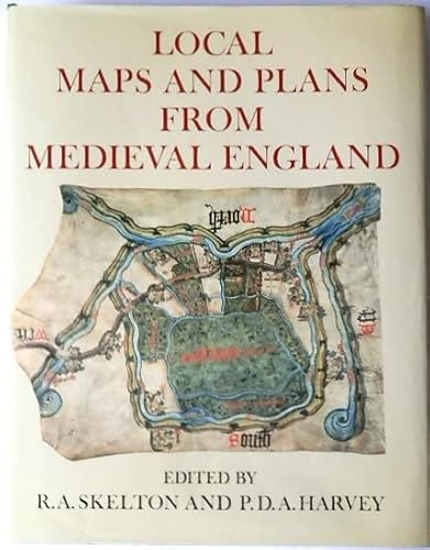
This is a major work of scholarship on the nature and significance of local cartography in the Middle Ages. It reproduces - in colour if the original is coloured - all local maps dated before 1501 that were known to survive when the book went to press; more than half have never before been reproduced or described in print. The volume has been produced to the highest standards by the Printer to the University, and is limited to an edition of five hundred copies, numbered by hand. The medieval maps of the whole of England or Scotland are few in number and well known; but maps of smaller areas in Britain from the Middle Ages have mostly been little investigated until now. In all there are thirty such maps or related groups: the earliest dates from the mid-twelfth century, but most come from the fifteenth century and they differ widely in purpose, style, and elaboration. Accompanying each map in this volume is an article by a distinguished scholar knowledgeable in the area, placing it in its local and historical setting. Modern survey maps of the same area are included in the articles for reference. The editor's introduction discusses the maps as a group, in the context of local maps from other parts if Europe and of the general early development of topographical mapping. Among other conclusions it is suggested that even the simplest sketch-map involves concepts that were not familiar to our medieval ancestors; that these maps had no connection with the development of surveying - the union of map-maker and surveyor was to come later; and that they share characteristics with maps produced in widely differing cultures and periods. The maps themselves vary from the roughest sketches to elaborate pictorial compositions; but they all reflect medieval man's response to the landscape around him and his attempts to portray it in what we now recognize as cartographic form.
��ber diesen Titel� kann sich auf eine andere Ausgabe dieses Titels beziehen.
- VerlagOxford University Press
- Erscheinungsdatum1986
- ISBN 10 0198223633
- ISBN 13 9780198223634
- EinbandTapa dura
- Anzahl der Seiten392

Beste Suchergebnisse beim ZVAB
Local Maps and Plans from Medieval England
Verlag:
Oxford University Press
(1986)
ISBN 10: 0198223633
ISBN 13: 9780198223634
Gebraucht
Hardcover
Anzahl: 1
Anbieter:
Bewertung
Buchbeschreibung Hardcover. Zustand: Very Good. Zustand des Schutzumschlags: Very Good. Limited Edition. Number 369 of just 500 such copies. Publisher's dark blue hardback with gilt lettering along the spine; firm and square. Complete with original dustjacket, very slightly rubbed and a little sunned even so showing well with no tears or chips. Contents sound and clean; a few pages very mildly creased nonetheless in very good shape throughout with no pen-marks and not from a library so no such stamps or labels. Size: 38cm x 30cm. Illustrated in colour. Thus a scarce book in very good condition. Artikel-Nr. 104625
Weitere Informationen zu diesem Verk�ufer | Verk�ufer kontaktieren
Gebraucht kaufen
EUR 353,56
W�hrung umrechnen